by: Paul Illsley
by: Paul Illsley
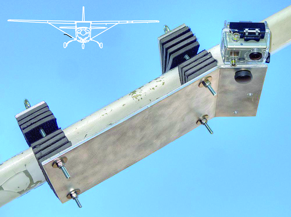
So I designed a simple Ľ inch aluminum plate wing strut mount for a Cessna 172 aircraft to hold the GoPro Hero2 camera. The mount fits along the underside of the strut and two back plates are placed on the top side of the strut. Numerous foam pads are placed between the strut and the plates, then the 6 inch retaining bolts are tightened (using self locking nuts with nylon inserts) to ensure a snug and safe fit. I also placed a strip of duct tape across the GoPro tripod mount retaining screw to ensure it didn’t loosen during flight.
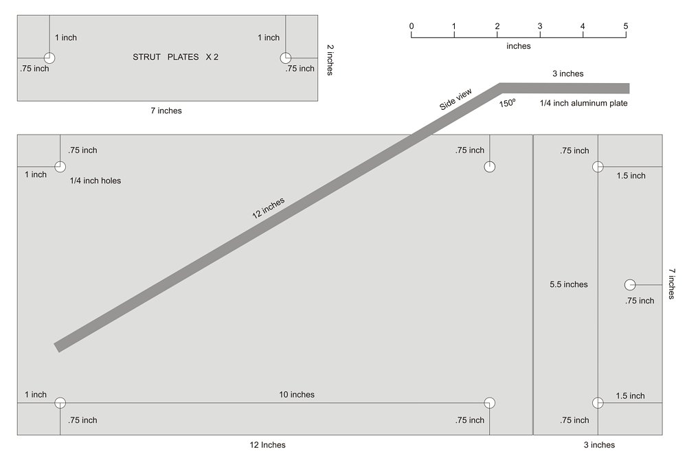
Plans for my Cessna 172 wing strut camera mount.
GoPro Hero2 camera performance bench test (@ 20 degrees Celsius):
(results will vary depending on battery condition and fluctuating atmospheric conditions)
Time interval: one image every 2 seconds (11 megapixels)
Battery: internal and backpack battery
Sequence duration: 3 hours, 33 minutes (battery not depleted)
Number of images recorded: 6354
Corrected image overlap (100.6 mph SOG, 1900 feet AGL): 85%
Memory used on SD card: 32 / 32 GB (memory card full)
Time interval: one image every 5 seconds (11 megapixels)
Battery: internal and backpack battery
Sequence duration: 5 hours, 41 minutes (battery depleted)
Number of images recorded: 4099
Corrected image overlap (100.6 mph SOG, 1900 feet AGL): 57%
Memory used on SD card: 17.1 / 32 GB
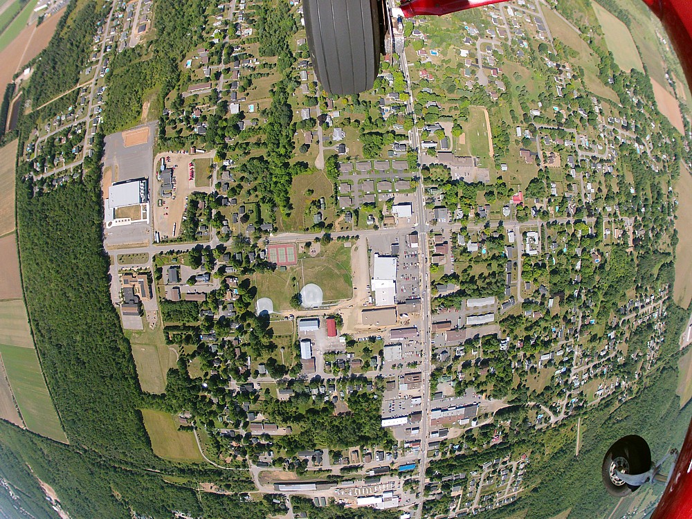
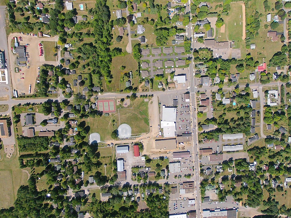
As you can see, the GoPro wide angle lens creates some serious barrel distortion.
Notice the landing gear in the top of the image and the front wheel in the lower right corner.
These objects will be removed when we correct the lens distortion.
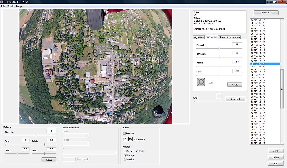
PTLens software before the barrel distortion has been corrected.
All the images can be corrected with a batch processing option.
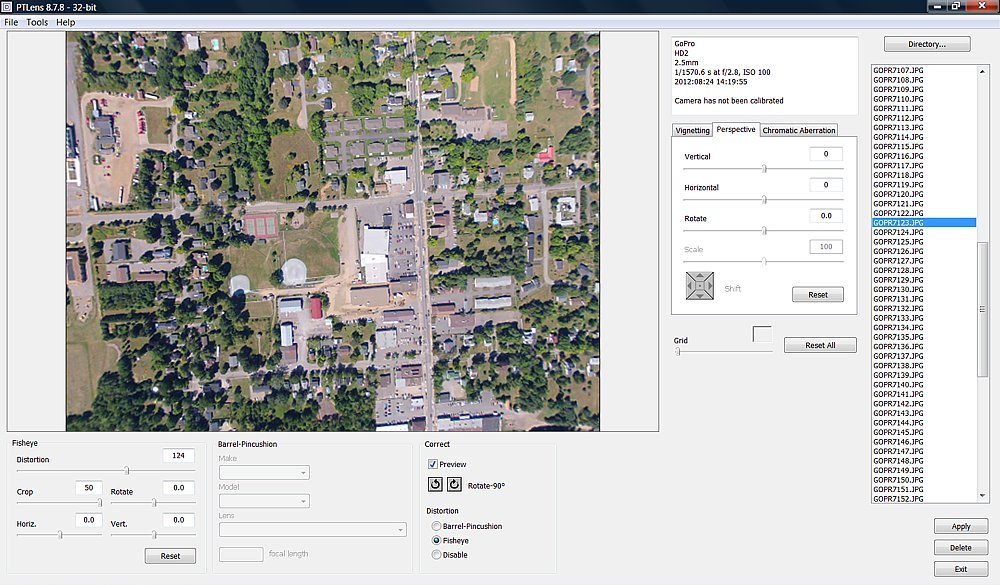
Screen shot of the distortion correction and cropping settings used for this project (Distortion: 124, Crop: 50, Distortion: Fisheye).
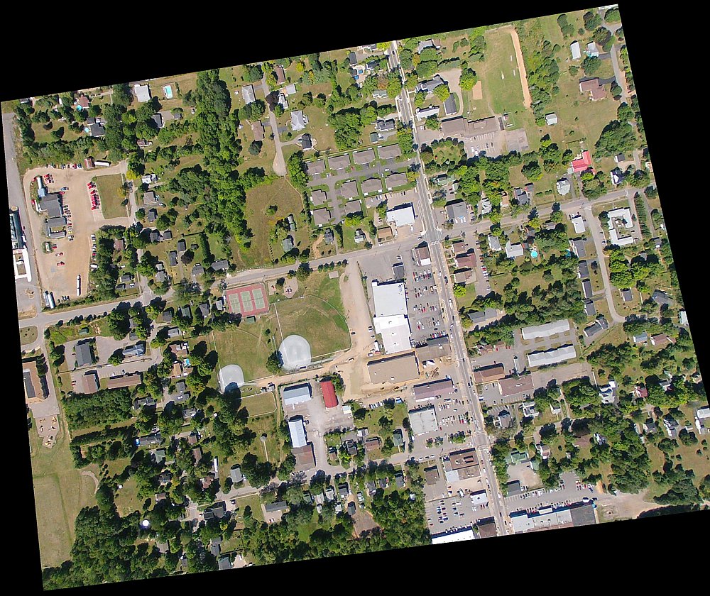
Final corrected and cropped image (approximately 800 X 600 meter ground footprint @ 1,900 feet AGL).

Now I wanted to see if it could be registered to already existing 1:10,000 scale road vector data (in red).
I used a 2nd order polynomial transformation and a cubic convolution interpolation procedure to register the image.
Click HERE to learn more about these terms and techniques.
This is the final product. Click HERE to view the full 0.25 m resolution registered image (2.25 MB).
It’s not a photogrammetric camera and it lacks some of the refinements of a true mapping sensor but if you want quick images at a low cost, this might just do the trick.
One issue I can envision is an exposure shift between images due to specular reflections (sun reflecting off a flat surface such as water) since the GoPro Hero2 only allows auto exposure imaging. Hopefully they will include manual exposure, raw image capability, and a less distorted lens option in their next model.
Another issue I have noticed with the GoPro camera system is the fact that it uses a rolling shutter to record the image. Unlike traditional still image cameras that record information for all pixels simultaneously, a rolling shutter scans the scene (very quickly) to write the data to the image. This means the top of the image is recorded before the bottom of the image and any movement during exposure will shift the image slightly. Any slight movement in the image geometry will cause serious degradation in the accuracy of your collected data.
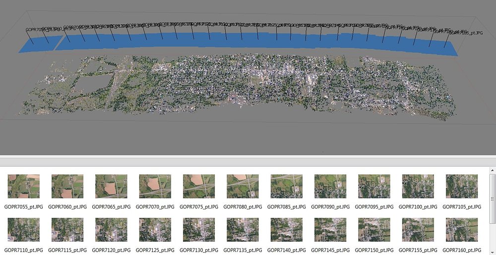

I then processed the points to create a Digital Elevation Model (DEM) to show the building and terrain on 3D.
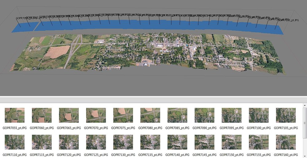
I then draped the 27 images over the DEM to create a continuous orthorectified mosaic of the 3.75 kilometer flight line.
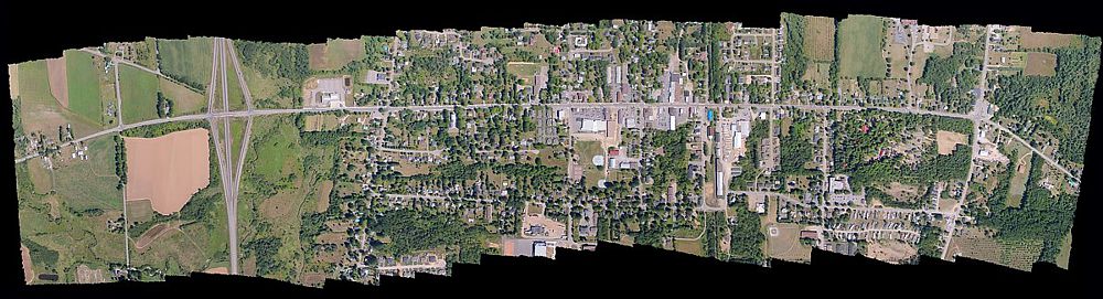
Final orthorectified mosaic created from all 27 images combined. Click HERE to view a larger image (not full resolution).