
Anegada Reef and Virgin Gorda, British Virgin Islands
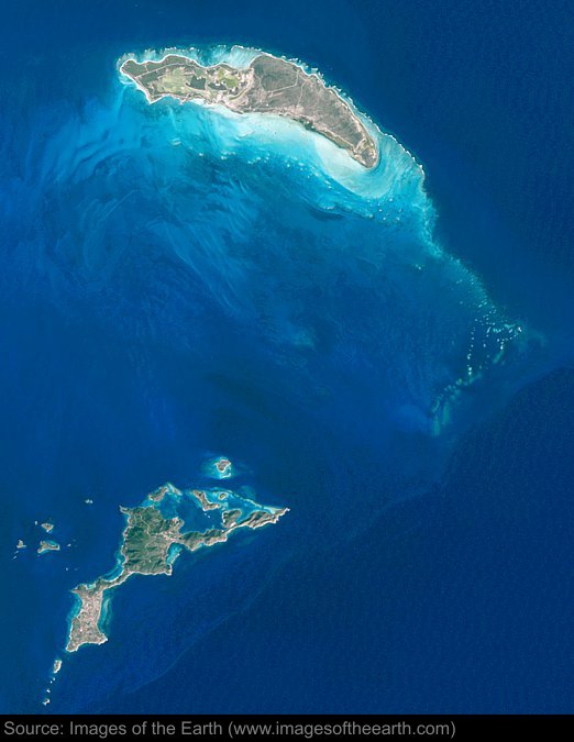
Approximate image footprint: 69 X 86 km
Coordinates: 18.64N, 63.37W
Date: January 24, 2003
Satellite sensor: Landsat 7 ETM+
Raw data credit: NASA
Spectral range: Natural color composite
Click HERE to purchase an 8 X 10 photographic enlargement for only $5.45 (more sizes are available).
Images on this site were compiled by Paul Illsley.
Return to Images of the Earth homepage.
|