
Sea ice off the east coast of Greenland
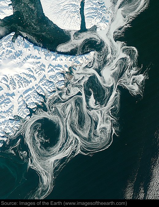
Approximate image footprint: 307 X 417 km
Coordinates: 69.86N, 22.75W
Date: October 17, 2012
Satellite sensor: Moderate Resolution Imaging Spectroradiometer (MODIS)
Raw data credit: NASA's Earth Observatory
Spectral range: Natural color
Click HERE to purchase an 8 X 10 photographic enlargement for only $5.45 (more sizes are available).
Images on this site were compiled by Paul Illsley.
Return to Images of the Earth homepage.
|