
Underwater Sand Formation, Bahamas
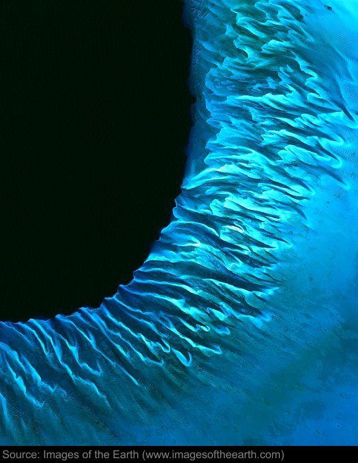
Approximate image footprint: 48 X 60 km
Coordinates: 23.41N, 76.65W
Date: January 21, 2000
Satellite sensor: Landsat 7 ETM+
Raw data credit: NASA
Spectral range: Natural color composite
Click HERE to purchase an 8 X 10 photographic enlargement for only $5.45 (more sizes are available).
Images on this site were compiled by Paul Illsley.
Return to Images of the Earth homepage.
|