
 Follow Ben on Google Earth: cycling2celebrate.kml
If you don’t have Google Earth installed on your computer you can download it free from: http://www.google.com/earth/index.html.
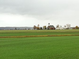
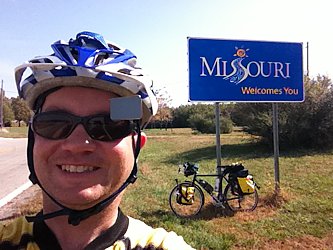
Day 79, November 16, Hancock, MD
Start: Cumberland, MD
End: Hancock, MD
Today's mileage: 64.4 miles
Total miles so far: 3302 miles
Average speed: 9.1 mph
Max speed: 15.4 mph
Travel time: (08:45 to 15:45) 7 hours
Total travel time: 401.5 hours
Weather: rain, overcast, 50-55 F
The rain was coming down as I rode through the gate marking the beginning of the C&O towpath in downtown Cumberland by the park service visitor center.
Cumberland is a CSX town and the train horns could be heard at all hours with trains coming and going. The rail lines paralleled the towpath for about half the day. Even when the trains could not be seen they were present with the low throb of the locomotive diesel engines, the clatter of cars on the rails or the screech of wheels going around bends.
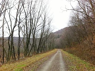
I had heard the towpath could be muddy when it rain. There was on section maybe a quarter mile long that I was a bit worried and rode unclipped. But it was not that bad.
The path is dual track from the tires of a truck. The bottom of the track is not level but it is mostly pea stones so not muddy. But the ruts form puddles. The puddles ranged from about an inch to six inches deep. The deeper ones were evident by a deep brown color from the fallen leaves decomposing in them.
Not being able to see the bottoms I had to coast through the deep puddles. The others I could cruise through at about 9-10 mph. Definitely happy to have fenders! Also happy to have waterproof panniers.
Day 78, November 15, Cumberland, MD
Start: Confluence, PA
End: Cumberland, MD
Today's mileage: 69.7 miles
Total miles so far: 3238 miles
Average speed: 10.3 mph
Max speed: 22.8 mph
Travel time: (08:45 to 16:00) 7.25 hours
Total travel time: 394.5 hours
Weather: drizzle, overcast, 50-55 F
Waking up to a hard drizzle or maybe rain, I went to eat breakfast at the Sweetie Bakery next to the pizza place I got dinner with the night before. Buying some donuts and a bagel with cream cheese I checked my email and hoped the rain would stop. The rain eased up and was only something between a mist and a drizzle when I headed back out.
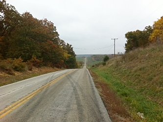
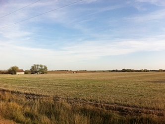
Before Meyersdale, was one of the big things on the trail today: the 1908 foot long Salisbury Viaduct. So not to lose elevation, the railroad made a big bridge to cross over a valley. The bridge is narrow -- one track wide -- which makes it seem even higher than it is. It looks too be about 100 feet off the ground (but probably only 60 or so) and only about 10 feet wide.
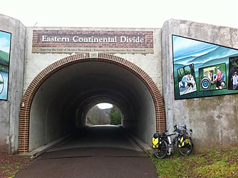
Today was going to be the "hardest" climb of the GAP trail. It goes over the Eastern Continental Divide and I could actually tell it was a little bit harder despite it being less than a one percent grade. It might have been the wet surface making it a bit slower too.
The divide is worked marked on a tunnel with murals depicting the settlers going west and the industry of the area. It is the highest point on the great Allegheny passage at 2392 feet. All downhill from there.
The other big thing was the Big Savage Tunnel. It is 3294 feet long through Big Savage Mountain. I was concerned that the tunnel might be closed because on the map it says it closes in late November. I tried to call the GAP offices to check whether it was open since the website does not have the status but I got no answer until a couple days after I'd already gone through. The map also says that there is no easy way around the tunnel. It looked to me that there is a trail that headed over the the top of Big Savage Mountain which I could have either pushed my bicycle or rode my bicycle over and that would've gotten me to the other side. Riding through the tunnel was a little disorienting despite it being lighted. In the reduced light and the speed I was going I felt like I was floating.
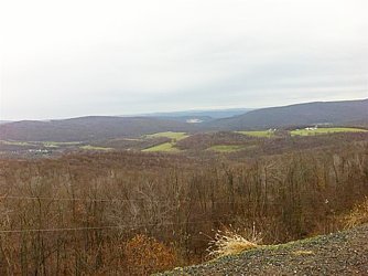
After the Big Savage Tunnel it was a nice ride down to Cumberland. I could coast most of the way at about 15 miles an hour. There were another couple of tunnels -- the Borden Tunnel and the Brush Tunnel each over 900 feet long. From Frostburg to Cumberland the path follows the Western Maryland Maryland Scenic Railroad. The rides start from Cumberland in the morning and I did not see any trains. The brochure says you can take your bicycle on the train. It could be an interesting way to cover those 32 miles from Cumberland.
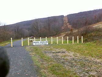
Before reaching Cumberland, you cross the Mason Dixon Line and officially are in the Southern US. After visiting the the C&O Visitor center to get a map and see the exhibits on the canal, I rode around town a little. Both the Holiday Inn and the Fairfield Suites had hoses outside specifically to clean off bicycles. I used a hose to clean mine since the chip stone used on the GAP path had gotten up into my chain. Every turn of the cranks reminded me of having sand in my teeth. My poor chain and gears!
I also went to the local bike shop to check on conditions of the trail. The drug dealer in Pittsburgh told me the C&O trail could be muddy. My aunt also said she had heard the same. I was concerned that my tires were not wide enough plus they were not knobby. The salesman assured me that my tires were wide enough and that I wouldn't need knobby tires. He said the trail gets more wet than muddy although there are puddles that can be deep and can be muddy. He said that if the puddle has steep sides just run through the bottom of the puddle don't try to go up the sides is you could slip and fall.
I had dinner at the Baltimore Grill in the center of downtown on the pedestrian mall. I think my waitress was surprised at the speed I ate. Each time she came by to ask if everything was OK, I'd already eaten the whole plate. I must have been hungry because I even got dessert which was a little unusual. But I polished off the chocolate cake as well.

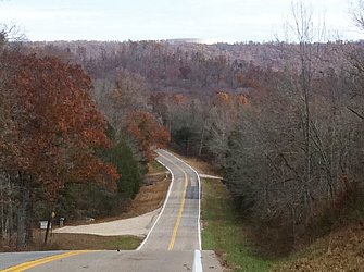
Day 77, November 14, Confluence, PA
Start: West Newton, PA
End: Confluence, PA
Today's mileage: 63.9 miles
Total miles so far: 3168 miles
Average speed: 10.2 mph
Max speed: 19 mph
Travel time: (08:15 to 16:00) 7.75 hours
Total travel time: 387.25 hours
Weather: drizzle, partly cloudy, 50-70 F
There was a light drizzle leaving in the morning. Not cold but a little chilly to start.
The surface of the trail is compacted chip stone. Due to the rain last night it seems a couple miles an hour slower than yesterday when dry. Still able to go about 10 mph. There are also a lot of wet leaves on the trail but they seem pretty stable and I haven't felt any slipping.
There are little towns every five to ten miles along the route. Most have a look they were started 100 years or so ago when this corridor was heavily used judging by the style of houses.
In Connellville, I liked the Appalachian trail type huts to the northwest of type for cyclists and hikers. I ate lunch at the NY Pizza & Pasta next to the big grocery store. I had looked at the services map of the town by the bike path when coming into town, and checked out a few other places first. Despite the "open" signs on the sidewalk everything else looked closed. They might only open when lots of people come through -- April to September.
Leaving Connellville the trail enters a gorge where the river narrows and becomes more wild with rapids and rocks. The low angle sun on the steeper valley, remnants of fall color, and the river created a beautiful place to ride for almost 30 miles. There were no houses or other signs of settlement in this stretch. Most if this run is inside the Ohiopyle State Park so With no towns, other people on the trail and no mobile reception it was almost, but not quite, a wilderness. The CSX tracks on the other side occasionally rumbled with a train and the horns sounded down the valley at distant towns.
Past Ohiopyle were coke ovens for processing coal into coke used in steel mills. At the time the area boasted on of the highest number of millionaires in the country including the Fricks who named many art museums. Now all that remains are a few remnant company towns and nearly overgrown, brick coke ovens.
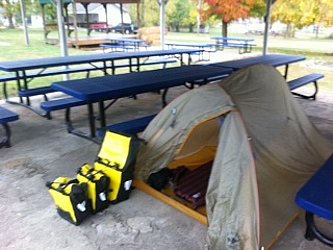
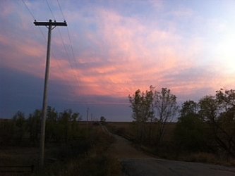
Arriving in Confluence shortly before dark I found that all the B&B's had closed for the winter as had almost all the restaurants. There was only a bar and a pizza place open. I had a steak and cheese sub at the pizza place. I decided to camp in the Overflow State Park camp ground despite it being closed. The bathrooms were open which is all that mattered to me.
I camped out underneath the picnic pavilion which not only was near the bathrooms, but was covered protecting me from the forecast rain.
Day 75, November 12
Waking up, I had a fear, "What if I can't get on Greyhound?" I'd bought the fully refundable fare so I could travel anytime plus could get a refund.
So I started trying to think of what to do if Greyhound didn't work. A one-way rental car is now only possible airport to airport so I'd have to get to Lexington, KY which is about 50 miles from Berea. A day's work. Plus the rental companies now charge about $200 as a fee for one way rentals. So I was going to have to spend $350 to rent a car from Lexington to Pittsburgh.
Then I realized there is still a company that gives a one way rental: UHaul. I could rent a ten foot box truck from Berea to Pittsburgh for $350 and unlike the car rental I could take up to three days to get there. Expensive option but an option.
As so often is the case, Amtrak was not an option.
I got the chair car taxi from the motel to the bus stop. The bus arrived and was less than half full. The driver got off, looked at the big box and exclaimed, "There is no way that will fit...but I guess we can try."
We moved one suitcase and it slid right on. I don't know why he thought it wouldn't fit.
A long distance bus ride always provides some interest. The ride was fairly uneventful. I transferred in Columbus, OH. Taking my bicycle box off I was glad there was only going to be one transfer. It was looking much worse even than before. Coming into Pittsburgh There was terrible traffic and we arrived at the downtown bus terminal an hour late. It was about 8:30 PM.
In general, bus terminal can be sketchy and become more so later at night so I wanted to be out of there quickly. But there was the whole 're-assemble' the bike thing slowing me down.
With my stuff spread out on the floor and my bike starting to come together, I met the guys who sell marijuana inside the bus station. The first was from SF and asked me about my trip for a few minutes before checking if I wanted to buy any weed. I declined.
He next tried to sell it to a guy making regular trips back and forth to the storage lockers. That led to a heated exchange as the other guy also sold weed in the station and considered it his turf. After the first drug dealer left, the second came over to survey my bike.
He noted, "Wow! A Surly Long Haul Trucker!" He either had a LHT or another bike by Surly called Pugsley. He asked a bunch more questions about my trip. Then he said, "You must be here for the Great Allegheny Paasage and C&O trail to DC. It starts just down the street from here..." He continued on with some info about the trail conditions and assured me despite the forecast rain it would not be too bad, although the C&O could be muddy.
By the time I rolled out of the bus station it was after 9:00 PM. The convention center was next to the bus station so I headed that way for hotels. Finding the Marriott and negotiating a discount I decided it was about as good as I could do downtown with having to bike miles at night in an unknown city.
Day 74, November 11, Berea, KY
Start: Harrodsburg, KY
End: Berea, KY
Today's mileage: 52.4 miles
Total miles so far: 3065 miles
Average speed: 9.8 mph
Max speed: 32.9 mph
Travel time: (9:00 to 16:00) 7 hours
Total travel time: 393 hours
Weather: partly cloudy, 30-45 F
This morning was very cold when I got up -- about 25 F. Even after the sun was up for a hour it was still below freezing. It would be a slow start. I normally go slow to warm up but today would be even slower and involve multiple stops for layer adjusting.
Looking at the ACA route, there would be no restaurants along the way to buy lunch. I'd be snacking it today. Plus with it so cold, I would not be sitting by the roadside to enjoy a lunch either. Somehow this 52 miles felt like a long distance between services sort of like being out west.
The ACA routes are nice because they try to put you on roads with little traffic. Today was certainly one of those days. It seemed like hours that I could ride in solitude with no noise but my tires and the birds.
I did run into a few dogs who charged my bicycle barking but now I have found that if I ignore them they lose interest pretty quickly. But there was one today I could not ignore. He ran out in front of my bike right in front of the tire. I was going about 12-14 mph which seemed a little fast for him to run along with his head turned completely around barking at me. It was a little comical but I was worried about running him over. I kept having to brake and steer aside. Eventually he gave up.
Berea seems like an interesting town. There is a college there that specializes in handmade arts and as a consequence there is a strong artist community in town. The welcome center off the interstate has all sorts of the local artists' work - ceramics, steel sculpture, paintings, wood carvings, and other things.
The college was founded in 1855 and the old town character has been retained in parts of town. Unfortunately, my goal was to go to the side of town next to the interstate with the characterless motels, strip mall shopping, and parking lot centered dining.
The Greyhound station is on that side of town. I have been contemplating how to finish my trip. I wanted to ride into DC and be done before Thanksgiving. There was no way I'd be able to do the roughly 800 miles in ten days while going over the Appalachians.
I had thought of getting as far as I could and then continuing after Thanksgiving. That would have me finishing going over the Appalachians in December. Definitely a cold and potentially snowy option. Not one to look forward to.
When in Steamboat Springs, a guy Nick who sounded like he lived riding his bicycle around suggested the Great Allegheny Passage and C&O towpath from Pittsburgh to DC. It is about 340 miles long of flat bike path. I figured I could do that distance in roughly a five days maybe six. That would put me in DC for the weekend before Thanksgiving to visit with friends then go back to Massachusetts the Monday before Thanksgiving to avoid the bad pre-Thanksgiving traffic. (Nick was heading south to Baja for the winter.)
I bought my bus ticket and the woman informed me that I'd have to package my bicycle, and that she had no materials for me to do it. She suggested going to Walmart. Since it was already almost 5:00 and the bus left at 10:00 PM, I had five hours to figure something out.
First I rode up behind the Walmart, and standing next to the cardboard crusher the guy told me they never have cardboard so they couldn't help me. He did not seem the most imaginative guy I'd ever met so I gave up on getting anything from him. I briefly rode up the road but didn't see the kinds of stores that would make large amounts of cardboard (furniture stores, lumber yards, etc).
Seeing I had only four more hours I went back to Walmart. I bought clothes line, duct tape, and five moving boxes. I strapped it all onto my bike -- lucky I had been in China so I knew everything certainly could go onto the bike -- and rode back to the Greyhound station.
Removing the handle bars and unpacking everything I set about packaging it. Total mess. The cheap cardboard boxes tore. They seemed brittle or dry. After two hours I had it all tied up in a messy bundle that I hoped would last the 400 mile ride including a transfer in Columbus, OH.
Being done at 8:00 I was done creating the mess, and now was just to wait in the darkness and increasingly windy and cold night. Standing out in the cold for a couple hours and pacing about, I wondered where the bus was when it passed 10:00.
At 10:20 the bus finally pulled in. The driver got off, looked at me with the huge bike box and asked, "What am I supposed to do with that?" Being a long weekend for Veteran's Day, the bus was packed. He told me there was no room and to try again later.
Now that my bike was packed up there was no way I was going to unpack it. The local taxi company was also at the bus stop so I got a taxi (they had to use a chair car in order to fit the bike box) to a nearby motel.
Exhausted and frustrated I fell asleep ready to get up early to try again at 08:45.


Day 73, November 10, Harrodsburg, KY
Start point: Bardstown, KY
End point: Harrodsburg, KY
Today's mileage: 48.4 miles
Total miles so far: 3013 miles
Average speed: 10.8 mph
Max speed: 34.8 mph
Riding time: (08:45 to 14:15) 5.5 hours
Total riding time: 386 hours
Weather: partly cloudy, 35-45 F
I stepped out in the morning just before sunrise, and was faced with a crisp, cold morning. It was below freezing by quite a bit. The weather channel said it was about 24 F. I had some breakfast and hoped it would warm up by the time I was ready to go.
When I left the temperature was just about freezing. I bundled up so that I'd warm up warm instead of trying to go out cold and warm up. I knew that I'd have to change out of something in about twenty or thirty minutes. The day was somewhat breezy so it might be even longer.
Today's ride would be once of the longest distances between services since Colorado or maybe Nevada/Utah. It was going to be 52 miles to the next place. I carried along some extra snacks, but figured I sort of go without a real lunch. Being a bit cold, I wouldn't want to sit outside for an hour to eat a real one.
I stopped at a gas station just out of town to get some Gatorade. The clerk commented that there were lots of cyclists who stopped there. He said during the summer that it was generally three or more a day during the summer. I mentioned that his store was on the TransAm cycling route. He was surprised. I wonder if some of the people on the route think that everywhere in the country gets so many cyclists going through if they don't know they are on a special route. He also noted that it was cold outside and no other cyclists had come by in a couple months. I noticed that too. Sometimes I'd see the big V-formations of the Canada geese heading south for the winter, and I'd wonder, "Do they know something I don't?"
The rest of the day's ride went through what seemed to be more horse country with rolling farmland and green pastures.
Arriving a bit early in Harrodsburg, I went to the library to empty my GoPro memory cards since the computers in Bardstown were so slow.
Day 72 , November 9, Bardstown, KY
Start: Hodgenville, KY
End: Bardstown, KY
Today's mileage: 35.9 miles
Total miles so far: 2964 miles
Average speed: 11 mph
Max speed: 34.5 mph
Travel time: (10:45 to 16:30) 5.75 hours
Total travel time: 380.5 hours
Weather: rain, drizzle, partly cloudy, 60-65 F
I woke up this morning thinking I had to get going to cover a lot of ground. But I stopped myself. The birth place of Abraham Lincoln was just minutes away. I could not be this close without visiting. I had read Bill Bryson's less than enthusiastic description...but he basically hated everything he saw while driving through the USA so I didn't feel it was a useful guide.
The birthplace park is small. There is a visitor center and a stone, monumental building that houses a log cabin. The cabin is supposed to represent the cabin that Lincoln grew up in. Unfortunately, the monument was closed for repairs, but the visitor center was interesting.
The rain started as I got ready to leave the birthplace. The route would take me by the Lincoln homestead and another farm that Lincoln lived on as a child before the family moved to Illinois.
The farm was in a little valley that was extremely picturesque. The steep hillsides came down onto a lush green field. If it had not been completely pouring rain I would have stopped for more than a few minutes.
From there it was only a few more miles into New Haven where I stopped for lunch. The only place that seemed open was the Subway. So I stopped there to refuel myself and recharge my GoPro. I bought a foot long Philly cheese steak thinking I'd save half for later but ate it all in short order.
Next to the little shopping area of the subway was the Kentucky Rail Museum. I decided to stop in as Bardstown was only about 20 miles away and it was still early. Plus during lunch the rain stopped.
Unfortunately, part of the museum's exhibits were closed for repairs due to a leaking roof. These were all their model railroads. The other exhibits were interesting but not too much. There was also a viewing yard to look at some old trains and cars. I think the pride of their collection is a Chesapeake & Ohio steam engine. It is not in working order yet still impressive in size with eight drive wheels taller than me.
From New Haven it was just another hour or so to Bardstown. Approaching town there is a distinct odor. Despite having never smelled it before I was pretty sure what the sweet and a bit decomposing odor was: mash for whiskey. Sure enough there was a distillery at the western edge of town. It makes the 1792 brand of Kentucky bourbon. I was four minutes too late for the free tasting.
I considered camping but the camp ground was outside of town a ways and the weather forecast was for a cold night in the 20's. Sleeping would not be bad but getting going in the morning. Plus I wanted to test some local bourbon so riding in the dark after a couple bourbons probably would not be a good idea.
Coming into Bardstown I went to the library to empty some memory cards. World's slowest computers. It was about 45-60 minutes per card; I'd never had it take longer than 20-30 minutes before. Slow computers are one of the most frustrating things.
I also took the opportunity to look at some maps to figure out how I was going to end this trip. Would I be riding after going home for Thanksgiving? Would I continue on the ACA route to Virginia and then up to DC? Bus some? Train some? I was on about Plan D by now.
I decided to stay at the Best Western in town as the B&B I called were about $30-50 more. It was after dark when I rode over to check in. Dropping my bike and I headed out to get something to eat and drink.
Completely ignoring the front desk's recommendations of Chilis, Pizza Hut, Sonic, and others, I headed into the center of town where I'd seen some taverns. I ended up at the Old Talbott Tavern which said it had over 100 kinds of Bourbon to try. (I didn't think I'd get to them all tonight.) I ordered a burger for dinner and after eating decided to try a couple bourbons.
The guy sitting next to me was an IT consultant from Minnesota who was there on business. He had decided he was going to try every one they had. He was about one third of the way through. Mind you, he had been coming to Bardstown on and off for the past four months. It was not done in a day. I asked him for some recommendations.
He suggested I try a single barrel called Wilmette. I did and noted it was much nicer than Jim Beam. The bartender said Jim Beam is only for mixing, not drinking alone. Hard liquor not really being my thing and having to ride again the next day, I had one more (Woodford Reserve) then called it a night plus the bar was closing.
The consultant suggested next time I come through to stay at the tavern. There were some rooms and having also stayed at the Best Western he said they were just as good but had character and were cheaper. So when I do my ride of the Kentucky Bourbon Trail I will keep that in mind.

Day 71, November 8, Hodgenville, KY
Start: Falls of Rough, KY
End: Hodgenville, KY
Today's mileage: 59.6 miles
Total miles so far: 2928 miles
Average speed: 11.1 mph
Max speed: 33.2 mph
Travel time: (09:30 to 17:45) 8.25 hours
Total travel time: 374.75 hours
Weather: partly cloudy, 55-70 F
I had the thought today another reason to miss cycling in the west. The route is easier to follow. In Nevada, the basic instruction is: "Get on Route 50, follow until you leave the state."
Now I have to pay attention to street signs and the unmarked ones are fun so I have to remember to check both instructions and bike computer.
Today I looked at the elevation profile and saw a whole bunch of spikes that made my thighs burn just looking at the spikes. Oddly, I did not notice those hills while riding.
As with previous days, and most likely those to follow, the terrain was rolling farm land.
In Sonora, there was a sign commemorating Carl Brashear, the US Navy diver played by Cuba Gooding, Jr. In the film Men of Honor. Brashear had been born nearby.
Day 70, November 7, Falls of Rough, KY
Start: Sebree, KY
End: Falls of Rough, KY
Today's mileage: 77.1 miles
Total miles so far: 2869 miles
Average speed: 10.7 mph
Max speed: 33.9 mph
Travel time: (07:45 to 16:45) 9 hours
Total travel time: 366.5 hours
Weather: partly cloudy, 50-65 F
Today had more chicken farms. And more dump trucks of chicken crap leaving a wake of putrid stink.
I have decided that dogs aren't as scary as I thought they'd be. Yes, when they come charging out of nowhere it can be startling but otherwise not much. I found they can't seem to tell the difference between me and my bike. So the bark at the spinny bits on either end not realizing the spinny bits in the middle would be most tasty. Most of the dogs seem to be herding types so it is more in their nature to run along barking trying to herd you.
I still will reach for my pepper spray on occasion but for the most part I let the chase and bark until they get bored or cannot keep up.
I did reach for my pepper spray when a large Doberman came charging. Luckily its owner called it back before it got out of the yard and there was no reckoning.
I have noticed the only state where my bike computer was not accurate was Utah. Every other state if the sign says 10 miles, I arrive at ten miles plus or minus just a little. In Utah I'd arrive at 13 if it said ten. I found it somewhat depressing there so it is nice now to know that ten miles really is ten miles.
Day 69, November 6, Sebree, KY
Start: Marion, KY
End: Sebree, KY
Today's mileage: 45.3 miles
Total miles so far: 2792 miles
Average speed: 10.9 mph
Max speed: 32.1 mph
Travel time: (09:45 to 16:45) 7 hours
Total travel time: 357.5 hours
Weather: clear, 45-60 F
I planned on going to Sebree today. Not too ambitious a distance. My decision was partially based on the Baptist Church in Sebree being renown for its hostel quarters for cyclists. It also satisfied my requirement of 45 miles a day.
The road was through forests with a few farms. I came across a new kind of farm: chicken farm. There were several Tyson farms. They are long single story buildings with giant fans on the sides, and a terrible, foul odor. Funny how there are no chickens visible but more foul than a feed lot. Chicken farms proved to me that breathing is necessary while cycling. No matter how hard I tried not to breathe so I wouldn't smell it, I couldn't. The dump trucks full of chicken crap also challenged my breathing leaving a trail of odor.
While riding along I thought about miles and and time I had left before calling my trip over. The thoughts were getting me a bit down. Then I looked up and saw a bald eagle. I've seen a lot of hawks and, now in Kentucky, turkey vultures but no eagles. Seeing it reminded me why I like doing this trip.
On the way to Sebree signs for property owned by coal mining companies reminded me that Kentucky is coal country. Kentucky also starts to be tobacco country with the drying barns.
I stopped by the roadside to eat lunch. The occasional pop of gunfire could be heard reminding me that camping out is not a good idea during deer season except at real campsites. Clouds came in and it cooled off so I got back on the bike.
The church had a room and mattress for me plus showers. As an extra bonus they had extra pizza from a lunch earlier. I had that for both dinner and the next day for breakfast and lunch.
The church backs up to the CSX main rail line from Atlanta to Chicago so there were frequent freight trains going by blowing the horn for the grade crossings in town. Being coal country, there were fewer coal cars than I expected. Lots of tank cars.
Day 68, November 5, Marion, KY
Start: Golconda, IL
End: Marion, KY
Today's mileage: 39.9 miles
Total miles so far: 2746 miles
Average speed: 10 mph
Max speed: 33.5 mph
Travel time: (10:30 to 16:45) 6.25 hours
Total travel time: 350.5 hours
Weather: clear, 45-60 F
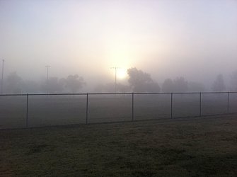
I had big plans for today. I was up early, going to Dari Barr fir breakfast then start riding at sun-up (07:15 or so). As soon as I opened the door if the motel I knew there'd be a problem: fog. Dense fog.
In the darkness visibility was only about 100 feet. I carefully rode down to the Dari Barr diner with all lights flashing. It was about half full at 06:15 but the parking lot was full.
Overhearing other conversations, two people had hit deer with their trucks that morning because as one said "I couldn't see where I was going." That was good enough for me to wait.
When the library opened at 09:00, I went over there to use the Internet. Then went to the post office to mail some excess. The fog finally clear almost instant at 10:00. I headed out. My new goal was Marion, KY. There was a good place to stay at the United Methodist Church in Marion.
Once the fog cleared it was sunny and warm. The route was more up and down among rolling farms mostly grazing for cows. When I got to Elizabethtown I had lunch and immediately after took a nap in the pavilion down by the river. I was supposed to be only a twenty minute or so nap, but turned into close to an hour.
This nap endangered my arrival in Marion after dark so I started to go. The road was a back road with steep hills. After an hour or so of the winding back road it ended up in Cave In Rock where the ferry goes across the Ohio River.
The ferry seems like something left over from another era. A little tug is mounted to the side of a vehicle barge and brings it back and forth bank to bank.
On the other side is Kentucky and twelve miles to Marion. The county has a lot of Amish which is evident by the horse apples in the road creating something to avoid riding through but unfortunately the odor could not be avoided.
I arrived in Marion in good time and before sunset. I had set up in the church building and showered before heading out to dinner at the Italian grill. Thinking that lettuce and tomato on top of a bacon cheeseburger was not sufficient, I craved a salad and their Greek salad hit the spot.


Day 67, November 4, Golconda, IL
Start: Carbondale, IL
End: Golconda, IL
Today's mileage: 71.3 miles
Total miles so far: 2707 miles
Average speed: 11.2 mph
Max speed: 37.7 mph
Travel time: (09:15 to 18:00) 8.75 hours
Total travel time: 344.25 hours
Weather: overcast, 40-50F
Last night I fell asleep immediately after getting back from Thai Taste. I did not even get my sleeping bag out of it's stuff sack. At midnight I woke up and got into my sleeping bag and fell back asleep.
Waking up at almost eight in the morning I realized I had not set an alarm and had slept for nearly 12 hours. I had been planning on leaving Carbondale around 8:00 to make sure I made it to Golconda before dark.
It was overcast with a high chance of rain. The air was chilly -- not too cold, but lots of moisture to give it that extra chill.
The first couple of towns I went through were different than most -- there was no main street looking main street. The road wound through but no main shopping street.
I stopped at the Sub Shack in Goreville for lunch. When asked what I wanted to drink, I answered, "What hot drinks do you have?" I got a big cup of coffee to go with my bacon cheeseburger.
I ended up arriving in Golconda at dusk. I stayed at Michael's Motel to avoid the cold. It was at the top of a steep hill. I did a quick tour of Main Street. Despite overhearing people at both the diner and Mexican restaurant talking about the tough economy in Golconda, Main Street was almost fully occupied. This could be because Main Street was the location of the two highways into town intersecting plus the geography placed Main Street between two hills. It was nice to see compared to so many other towns that became spread out and Main Street is vacant.
Dinner was at Los Gracias - one of four restaurants in town. (Two are more bars than restaurant). The Mexican place and Dari Barr were recommended for food. I inhaled the enchiladas and went back to the motel to sleep.
Day 66, November 3, Carbondale, IL
Start: Chester, IL
End: Carbondale, IL
Today's mileage: 51.5 miles
Total miles so far: 2635 miles
Average speed: 11.6 mph
Max speed: 30.2 mph
Travel time: (09:15 to 15:30) 6.25 hours
Total travel time: 335.5 hours
Weather: overcast, drizzle, 40-50F
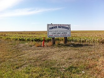
Leaving Chester I took the alternate Mississippi River levee route. It is the same distance as the main route but far fewer hills. Plus I hoped for some views of the Mississippi and I have seen enough rolling farm land.
Reading some of the entries in the guest books in Farmington and Hutchinson there were people saying the coal trucks were really bad and not to take the route or to wait until Sunday. For me, waiting several days was not an option.
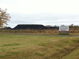
There were a lot of coal trucks for the first five miles. I often got off the road to let several pass me. They came in both directions. But five miles in was a coal terminal for transferring the coal from truck to barge. After that, I did not have any trucks plus then the route gets off Route 3 and goes onto a road on the levee so there was no traffic at all for about ten miles.
The route did go near a train line and this was busy. It was a double track and I saw at least five or six trains. Long trains with many coal cars.
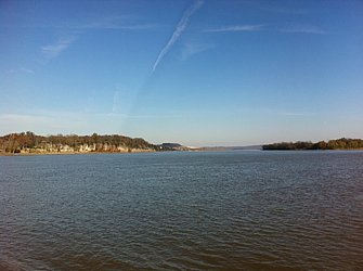
The levee was not right by the river so only once did I get to have a good view.
I stopped for some fried chicken at the Bottoms Up Bar & Grill in Neunert before heading on to my goal of Carbondale.
Carbondale is home to Southern Illinois University and consequently had three Indian restaurants, Greek, Thai, as well as supporting three bike shops. According to my warm showers host who worked at one, during the summer they have at least three people a day who are riding cross country come into the shop.
I ate at Thai Taste. The chicken wings were pretty good. A welcome change from bacon cheeseburgers.
Day 65, November 2, Chester, IL
Start: Farmington, MO
End: Chester, IL
Today's mileage: 49.7 miles
Total miles so far: 2584 miles
Average speed: 11.3 mph
Max speed: 39.6 mph
Travel time: (10:30 to 17:15) 6.75 hours
Total travel time: 329.25 hours
Weather: mostly cloudy, 50-65 F
Kaza and I left Farmington a bit late, but Chester, my destination and I guess his too although the night before he had talked about going all the way to Murphyboro. I thought going all the way was a bit much.
I led the way and for the most part Kaza was pretty close behind but other times he'd be out of view. Halfway to Chester I decided to stop for lunch about a mile before Ozaru. I figure ozaru being an interstate offramp it wouldn't be too scenic. My spot had a nice patch of grass and views of rolling farmland.
Kaza had not brought any food so he said he was going on. I ate my lunch and then took a peaceful 45 minute nap lying on the grass.
I had not realized that Missouri had a wine country. Crown Vineyards proclaims itself to be Missouri's finest vineyard. I haven't found them yet on a menu otherwise I might try a glass. The vineyards also offered fine dining and the surrounding areas seemed better off than some other areas.
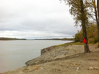
After more hills I reached a flat plain and could see to over what I thought must be the Mississippi River. Then I saw the bridge. Stopping before tge bridge was a sign saying that Lewis and Clarke started their voyage here. Approaching the bridge I realized it was very narrow without a shoulder. It was narrow enough that I didn't want anyone trying to pass me with oncoming traffic so I rode in the middle of my lane. A string of cars built up behind me for the couple minutes it took to cross. I was hoping for pictures of the crossing but there was no way to stop.
I did stop for a picture with me in front of the Welcome to Illinois sign plus to take a picture of the "Chester: Home of Popeye" sign. Then I went into Chester to find the Eagles lodge. It has a little bunkhouse and showers for cyclists. They conveniently have a restaurant too. There I ran back into Kaza who was finishing his dinner.
I showered, set up my bed, and then went for the strip steak dinner. The house special baked potato was good too.
My legs felt pretty tired. I feel that I am using my granny gear way more than I should be considering the hill I am on, but it is the one that feels right. I feel I should be able to do some of the less steep hills at least two gears higher but my legs quickly disagree with my brain.
I have nine cogs in the rear and a triple chain ring in the front. Speaking quite generally, there is a one mph difference switch cogs in the back. Switching chain rings on the front is about a 1.5 to 2 mph difference. The slowest I can go without fear of tipping over is about 4 mph in my granny going uphill. I generally go about 5 mph in my granny. Going on the flat I go about 18-20 mph. That corresponds pretty well with the 13 gear positions (ignoring all the intermediate variations). So on the hills that I have been using my granny gear recently I think I should be able to go 7-9 mph instead of my 5-6 mph that I am going. I guess it is not a big deal since the hills are not too big, but over the course of the day (and week) it adds up plus the immediate frustration of feeling like I could do better. Mind over body works for a few minutes but not long. I can make my body keep going just I can't make it go much faster for long.
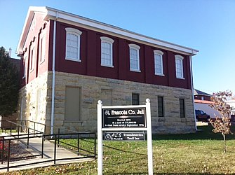
Day 62, October 30, Farmington, MO
Start: Ellington, MO
End: Farmington, MO
Today's mileage: 62.5 miles
Total miles so far: 2534 miles
Average speed: 11.3 mph
Max speed: 36.7 mph
Travel time: (09:00 to 17:15) 8.25 hours
Total travel time: 322.5 hours
Weather: mostly cloudy, 35-60 F
Chilly start.
It was another chilly start but the ride started out immediately with a nice hill. The grade was nice. I could put it in a low gear and slowly climb at about 5-6 mph and warm up. The grades today actually were often that way. Nice low gear steady climbs.
The day was windy but with the trees it was not too bad. Unlike Kansas with no trees the wind could not just rip through.
At lunch I hid by the visitor center at the Shut-in Park. It was nice to take break out of the wind, and take a little nap.
My warm showers hosts in Ellington suggested a short cut to Farmington that would save ten miles. That was nice. I was heading towards the cyclist hostel run by the town of Farmington.
On the way into Farmington I noticed a stencil on the road for Al's Place -- the hostel I was heading to. Pretty good having arrows all the way there.
Al's Place started in 2009 and is for cyclists heading through. It is on the old county jail and has beds for 14, showers, indoor bike storage, wifi/computer, plus a small kitchen. Pretty nice.
Tomorrow I'll head up to St. Louis for some sight seeing and visit a friend. Take my second day off since leaving Denver. My legs will like that.
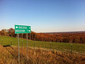
Day 61, October 29, Ellington, MO
Start: Houston, MO
End: Ellington, MO
Today's mileage: 75.3 miles
Total miles so far: 2472 miles
Average speed: 10.4 mph
Max speed: 39.2 mph
Travel time: (08:15 to 18:15) 10 hours
Total travel time: 314.25 hours
Weather: mostly cloudy, 35-70 F
Riding out of Houston was pretty cold. There was a freeze warning from the night before and frost was on the grass. I constantly was changing my clothes for the first hour or so trying to get the right amount on.
Going up hills was hot but going downhill was freezing especially hitting the cold air trapped in the little valleys and still in the shadows. After about 10:00 it was a constant temperature that I could ride without feeling like I had to change clothes with every variation of riding conditions.
Passing through some small towns, like Eunice, I noticed there were still post offices. I wonder how long that will last. All the post offices in Nevada, Utah, and Colorado are going away.
Again the day had lots of up and down. The ups and downs were created by valleys with streams and rivers. Some were dry, but most had water. There were more signs with water depth of up to three feet above the road surface.
Another day of no shoulder. Just a foot of shoulder would be somewhat welcome. Not only was there no shoulder but from the road it quickly dropped off down a bank into a ditch for much of the day. I started getting of the road and stopping sometimes to let vehicles pass.
The early part of the ride had horse trailer after horse trailer going west. I hoped that whatever they were going to would not end and then they'd all be coming back east and passing me.
I cannot believe how some people pass me. They pull completely into the oncoming lane then drive by on blind corners and up blind hills. that is probably the majority. The minority slow down and wait until it is safe to pass, or pass me not completely in the other lane. I try to be as mindful as possible making it easy and safe for people to pass me but I can't do anything about them being crazy on their own.
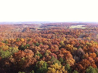
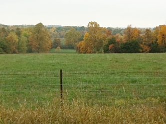
There were fewer fields and I was going through woods and spent a fair part of the day in the Ozarks National Scenic Riverways which is part of the National Park Service. The fall colors in the woods were out, but some trees have already lost their leaves.
The last 27 miles or so from Emminence to Ellington were really up and down. It felt like one of the harder rides I have done on the trip. I had to push on three occasions.
I had contacted a warm showers host in Ellington. She said to meet at the city park where there was a neighborhood Halloween party. When I arrived on Main Street and stopped to check a city map, a woman said I could contact Herman if I needed a place to stay. Having a place, I thanked her and rode the 1.5 miles south to the park.
At the park also happened to be another cyclist who was riding west. It was nice sleeping indoors again plus the hot dinner and breakfast.
Talking with my hosts I learned there were over 75 churches within the county of about 8000 people. Lots of them only have ten or twenty people. Definitely the bible belt. The other interesting comment was that besides church the other big following in the county was taking meth. Not a good thing to be following.


Day 60, October 28, Houston, MO
Start: Marshfield, MO
End: Houston, MO
Today's mileage: 69 miles
Total miles so far: 2396 miles
Average speed: 11 mph
Max speed: 37.4 mph
Travel time: (08:45 to 17:15) 8.5 hours
Total travel time: 304.25 hours
Weather: mostly cloudy, 40-50 F
Another cold morning but was able to get going only a bit later than expected.
Heading from the fairgrounds I went south and hit the old town center. It was nice but probably neglected due to the development heading over towards interstate to the west of town. I always feel sad to see these areas with character lose to the strip mall and parking lot centered development.
Next to the city hall in the center of the square is a quarter scale model of the Hubble Space Telescope. Edwin Hubble was a Marshfield native.
The climb up before Hartville was steep. I had to get off and push for a bit. Arriving in Hartville just before I stopped in the library for a few minutes. Hartville has retained a town center. It has two restaurants, library, a few stores, and court house all around a green.
When looking at my maps there is an elevation profile. Some of the hills look near vertical but I have to remind myself they are at most about 200' from bottom to top. That is small enough to easily push a bike up only slightly longer than pedaling.
I arrived in Houston shortly before dark. Being game seven of the world series I decided to get a motel room and watch the game. Plus waking up to a warm place would be nice.
Day 59 (October 27, Marshfield, MO)
Start: Walnut Grove, MO
End: Marshfield, MO
Today's mileage: 45.4 miles
Total miles so far: 2327 miles
Average speed: 9.7 mph
Max speed: 35.9 mph
Travel time: (09:30 to 16:00) 6.5 hours
Total travel time: 295.65 hours
Weather: mostly cloudy, 45-55 F
Waking up to the noise of rain on a tin roof was not encouraging until I remembered that tin roofs magnify the sound of rain. Out of my tent looking out I could not even tell it was raining and the sound soon stopped too.
I had decided to only go to Marshfield, about 40 miles, so I took my time. Going to Marshfield would get me on a better sequence for places to stay over the next few days.
More of the same up and down with steep hills. I had to get off to push up one hill for the last fifty vertical feet.
I checked the grades of a couple hills with the inclination app on my iphone. One was 12% and the other 14%. Not sure what my accuracy is on that, but it seems about right.
I noticed another thing that makes Missouri not like New England. Not church steeples. There are tons of churches - baptist, Mennonite, Christian, Lutheran, Methodist, etc. - but none have steeples. I have been struck by the numbers of churches in Kansas and Missouri relative to population. To me, I feel there are a lot. Bicyclists say you can often camp on church properties if you ask. Sometimes even stay indoors.
The weather cleared up a bit and after an hour I was riding without a jacket or hat. The forecast is for improving weather. So I decided to camp again. Calling the city of Marshfield, I got transferred to the animal control/parks department who set me up. They opened the showers at the fair grounds and left open the public restrooms in the city park. I camped under the gazebo just in case it rains since it is still overcast.
Dinner was at a Chinese buffet. I can't say it was the best Chinese food I have ever had. Maybe not the worst either. Sometimes meals make you think of a place you visited in a foreign land. The Hunan Garden reminded me of Medford, MA and eating at Panda although the buffet at Panda is way better both in quality and variety.

Day 58 (October 26, Walnut Grove, MO)
Start: Golden City, MO
End: Walnut Grove, MO
Today's mileage: 46.3 miles
Total miles so far: 2282 miles
Average speed: 9.75 mph
Max speed: 32.9 mph
Travel time: (09:45 to 15:30) 5.75 hours
Total travel time: 289.25 hours
Weather: overcast, drizzle, 45-55 F
I woke up early this morning to the sound of thunder and rain. It was nice being warm inside my sleeping bag in a dry tent under the picnic building.
I was half hoping the rain would be torrential and I'd have a good reason to take a rest day in Golden City. That could mean three more meals at Cooky's with more pie, a few naps, and reading.
But I ate breakfast and slowly packed up. With everything away except my sleeping pad and tent, the rain stopped at 9:30, and I got going.
Up and down, up and down was the order of the day. The scenery is pretty nice with farm framed by hardwood woods. The trees are turning color. It reminds me a bit of New England. I kept thinking of revolutionary war battle grounds. Although there are not the stone walls like in New England.
Another noticeable thing about Missouri is having dogs chase you. I pulled out my pepper spray a half dozen times but never had to spray any yet. A couple times I heard a lot of barking only to be chased by step-on dogs. Step-ons make a lot of noise but can barely keep up with me going uphill, and at about ten pounds don't invoke much fear. Once three big dogs tried to intercept me but being on a downhill they could only hope to catch me going 20+ mph.
I passed through a few small towns. I was planning on getting to Fair Grove today, but the up and down took more out of me than I expected. Plus I am sure the drizzle for the last hour coming into Walnut Grove didn't help.
At about 15:30 I was eating some marginal pizza at the gas station restaurant in Walnut Grove. I started talking to the man at the next table. He said if I wanted I could camp in the city park here instead of going on. Considering I had about two hours before dark and it being darker than normal with the rain clouds I thought it was an idea.
I went to talk to the sheriff who gave me the OK. While not as nice as Golden City -- no showers and the restrooms are locked -- I set my tent up under the picnic building so it would stay dry. And took a little nap before heading back to the gas station restaurant for some more marginal pizza plus Doritos and cookies.
Day 57 (October 25, Golden City, MO)
Start: Pittsburg, KS
End: Golden City, MO
Today's mileage: 39.6 miles
Total miles so far: 2236 miles
Average speed: 10.1 mph
Max speed: 27.3 mph
Travel time: (10:30 to 15:30) 5 hours
Total travel time: 283.5 hours
Weather: partly cloudy, windy, 70-85 F
Leaving Pittsburg the winds were whipping the flag at the post office when I stopped to mail home some maps I no longer needed. (3.5 oz) At least it was a south wind not a north.
The super cells that form over tornado alley from Texas to Nebraska are from hot, humid southern air running into cold northern air. The last couple of days with temperatures in the 80s in late October coincided with south winds. Tomorrow the forecast is for winds from the north and temperatures in the 50s. Luckily it is late in the year so there is no real danger of tornadoes.
The Adventure Cycling description of the route through Missouri includes someone commenting that riding through Missouri is doing a self propelled roller coaster. I started to see that today. The hills aren't big but they are steep and numerous.
Golden City is famous among TransAm cyclists. Famous for Cooky's and it's pies. They make their own pies and have generally about a dozen flavors to choose from. I went there for dinner. The dinner special was pork chop dinner. Fantastic pork chop. Then came the hard part of the meal, which kind of pie? I went with apple and vanilla ice cream. Really good apple pie. If I were not full I thought about trying another piece probably of black berry.
Outside Cooky's I talked with a couple of Harley riders from a couple towns over. They said I was much more hard core than them. We talked about riding in Missouri. I noticed they put on helmets. The only motorcyclists who have never waved are the harley riders (more like choppers) who don't wear helmets. My friend in Denver who rides motorcycles a lot said those guys won't wave to anyone and think they are too cool and generally mad at the world for no good reason.
Actually I noticed that in Kansas and missouri. Many people in cars, pickups, and semis will also wave.
The city park was very nice with a shower and bathroom. I camped under the picnic pavilion since it was supposed to rain that night and in the morning. There were soccer games going on until about 9 PM. Then the lights went out and everyone went home.
Day 56 (October 24, Pittsburg, KS)
Start: Chanute, KS
End: Pittsburg, KS
Today's mileage: 67.6 miles
Total miles so far: 2196 miles
Average speed: 10.1 mph
Max speed: 19 mph
Travel time: (10:30 to 19:30) 9 hours
Total travel time: 278.5 hours
Weather: overcast, 50-85 F
When I woke up at 06:30, the fog was thick. I couldn't see more than 100 feet. I could hear the cars and trucks on the highway a hundred yards away but couldn't see anything not even headlights. I was going to have to wait for it to clear. I won't ride if cars can't see me and I can't see them.
Eating breakfast and packing up, the fog was not clearing. I managed to cut my iphone charger cord with the cover for the RV hookup electrical box. Luckily, across the street was a Walmart. So once the fog suddenly cleared at 09:30 I headed across the street. Next to the iphone charger (ugly and clunky compare to the OEM cord) was an earphone that I could use in my iphone and other cheap phone. Unlike the original iphone headphones that hurt my ears after a bit, this one was soft and smaller. The biggest bonus was fitting into my cheap phone makes it an FM radio. (The radio function doesn't work without the headphone connected -- the headphones are the antenna.)
Riding out of Chanute was to the north then west due to road construction. The day would be filled with more rolling farmland and grazing land.
Some days stand out for something. Today was the carnage of small animals - raccoons and possums mostly. In some sections there seemed to be dead animals every hundred feet. I won't go into gruesome detail because it is gruesome.
I considered stopping in Girard but was uninspired when I got there. I was only 13 more miles to Pittsburg and an hour of light left.
Not knowing where the camp ground in Pittsburg was and it being dark, I stopped in a motel at the northern edge if town. Dinner was at Chilis. For a chain it is at least better than McDonalds or Pizza Hut which were my other options. There was also Yummy, a Chinese buffet, but without a single car in the lot I passed. One of these days I should try mid-western Chinese food.
Day 55 (October 23, Chanute, KS)
Start: Eureka, KS
End: Chanute, KS
Today's mileage: 73.9 miles
Total miles so far: 2129 miles
Average speed: 11.9 mph
Max speed: 33.9 mph
Travel time: (10:15 to 17:30) 7.25 hours
Total travel time: 269.5 hours
Weather: overcast, 50-75 F
Waking up at my usual 06:00, I got up and stiffly walked to the bathroom. I thought, "I don't think I can do another 90 miles today." Feeling a bit tired, I lay back down and instantly fell back asleep for a couple hours.
It usually takes me about an hour to an hour and a half to pack up in the morning. Partly to digest breakfast. Partly because I still think I have too much stuff and organizing it takes time.
The weather forecast for the day was good: west winds 5-8 mph, clear, 75+ deg. I started out wearing my legs, windbreak, silk turtleneck, cycling t-shirt and silk balaclava. In about an hour I was down to just my cycling T-shirt and cycling shorts. Perfect riding weather.
The ride was through more rolling farmland. Similar to other days. I had lunch at the Cross Timbers State Park by Toronto Reservoir. The trees are starting to turn. They don't seem to have the same fiery reds, oranges, and yellows like I remember from New England. It is more like just a brown.
I got to Chanute, checked out the city park in the south for camping and then headed downtown for something to eat. I did not want to eat at McDonalds, Sonic, or Pizza Hut which was all there was by the park. Main Street looks a bit run down like all main streets in Kansas, but it is not all vacant like some others. I ate at Opies which had a buffet with pizza, fried chicken, and salad. Not bad.
I rode the three miles or so back to the city park, set up my tent, took a shower and headed to bed.
Day 54 (October 22, Eureka, KS)
Start: Hesston, KS
End: Eureka, KS
Today's mileage: 92.2 miles
Total miles so far: 2055 miles
Average speed: 11.2 mph
Max speed: 23.2 mph
Travel time: (08:30 to 18:45) 10.25 hours
Total travel time: 262.25 hours
Weather: overcast, 40-70 F
Leaving Hesston, I turned on my audiobook on how the brain works. The only thing I can remember is that he said the average retention of new material is minutes. Seems about right. I remember laughing a few times at his jokes, but not what they were.
It was mostly cloudy or overcast and somewhat warm getting up to about 75 F. The wind in the morning was nearly calm. The day started out with rolling farmland surrounded with trees separating the fields. As the day went on the rolling hills got more rolling, the trees became fewer, and the cows became more.
I stopped for lunch in a harvested wheat field and after eating took a twenty minute nap in the warm sun. Oh, I remember the brain book said brain function is improved by 20 to 45 minute naps. I don't recall much else said.
After lunch, it became overcast with about an 5-10 mph southeast wind. It definitely slowed me down. It slowed me down and when I arrived in Cassoday, I briefly considered staying there since I realized I would not arrive in Eureka until after dark. But I figured it would ne close so I kept going.
The brain book finished so it was time for Too Big to Fail. I still have a few more days of that.
The sun was setting and I still had about 6 miles to go to Eureka so I donned all my reflective gear, flashing lights and rode in. As I got into town there was a restaurant bustling with people so I went there: Benny's Bar & Grill. Later I found out it was opening night so the town showed up to check it out. A woman advised me to get the burger and be aggressive tracking down the waitresses because they are still figuring it out. I followed her advice which turned out to be pretty accurate.
Day 53 (October 21, Hesston, KS)
Start: Hutchinson, KS
End: Hesston, KS
Today's mileage: 47.6 miles
Total miles so far: 1962 miles
Average speed: 13.4 mph
Max speed: 21.8 mph
Travel time: (14:30 to 17:30) 3 hours
Total travel time: 252 hours
Weather: sunny, 70 F
Late start because I decided to go back to the space museum to look at the Apollo and shuttle section since I ran through them as the museum was closing the day before. Arriving shortly after opening I stayed until after one o'clock.
Then I went back to the church, had lunch and started riding. I missed my turn and ended up doing an eight mile detour before getting back on route.
Day 52 (October 20, Hutchinson, KS)
I started by heading to the grocery store and then the hardware store. I was happy to find pepper spray on clearance at the hardware store. I bought two which should get rid of a few dogs.
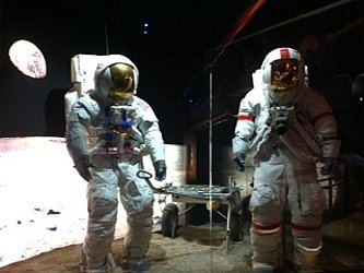
Then I headed over to the Cosmosphere. Being greeted by a real SR-71 Blackbird in the lobby was just the start. The space exhibits are amazing. Very comprehensive starting with a narrative that includes real V-2 and V-1 rockets, Operation Paper Clip, testing at White Sands, Mercury's Liberty Bell 7 recovered from 16,000 feet below the ocean, Gemini, the Apollo 13 Command module, and the space shuttle.
Not only that but the a whole history of the Soviet space program. Watching the Kennedy speech declaring we are going to the moon still gets me choked up.
The entrance ticket also included an IMAX movie and planetarium show. I watched Lewis and Clark which was pretty good too. The planetarium show was not too exciting and being simulated nighttime it was perfect for sleeping under the stars. I hope I wasn't snoring.
After the museum, I went back to the church to pick up my bike to ride to a BBQ place I had heard of: Hog Wild. I got the half rack of ribs dinner. Great BBQ ribs.
Tomorrow I'll start riding again. Probably not at dawn since it is freezing in the mornings.
Apollo missions.
Day 51 (October 19, Hutchinson, KS)
Start: Larned, KS
End: Hutchinson, KS
Today's mileage: 74.4 miles
Total miles so far: 1915 miles
Average speed: 12.8 mph
Max speed: 23 mph
Travel time: (10:00 to 16:15) 6.25 hours
Total travel time: 249 hours
Weather: partly cloudy, 35-55 F
Cold start to the day so I retreated until it warmed up a bit...at least to freezing.
Somebody at in Colorado told me that anyone biking across the US after me would be stupid because it would be cold. The other day I was thinking about that and broke out laughing. I thought, "it must follow that I am a bit stupid for going so late, but the next guy is even stupider. But what if there is no next guy? That would make me the stupidest." So I figure I could be the stupidest person cycling across the US this year.
Once I got going it was not bad and warmed in the sun. The wind was north northwest so a tiny bit of a tailwind and fortunately not the 20+ mph forecast. It was probably only 12-15 mph.
The following highway 19 south then east out of Larned the countryside was more wheat farms with gently rolling hills. There were more trees than before. Long wind breaks of trees and more creeks with trees.
Last night I purchased an audio book. It was great for distracting me from looking the bicycle computer to check my distance or speed. I don't really remember what the guy was saying but it made the time go by faster.
When I arrived at the bicycle hostel in Hutchinson, I looked over the last 14 years of the sign in book. Only one person stayed at the hostel after October 19 in the last fourteen years. So pretty much for the last fourteen years I would have been the stupidest person cycling across the US.
I plan on taking a day tomorrow in Hutchinson to visit the Cosmosphere, post office and library. The Cosmosphere has the largest space exhibit in the USA outside of the Smithsonian. I have no more memory cards so I have to transfer the data off them; should be a few hours at the library.
Day 50 (October 18, Larned, KS)
Start: Rush Center, KS
End: Larned, KS
Today's mileage: 33.6 miles
Total miles so far: 1840 miles
Average speed: 13.9 mph
Max speed: 26.1 mph
Travel time: (11:00 to 16:30) 5.5 hours
Total travel time: 242.75 hours
Weather: partly cloudy, 35-55 F
After going to sleep to the sound of rain pounding down on my tent, I was pleased to wake up to mostly clear skies and sun. I woke up very late for me. Usually I get up without an alarm at about 05:30 to 06:00. Today I was surprised to see it was 08:25 when I checked the time.
I went over to the farmers co-op gas station to use the bathroom. When I came out an old guy wearing a bright green John Deere hat asked me what I was doing. After I told him I was biking cross country and was camped in the park, he said, "You'd better get back over there. There is a black bear loose. It'll tear your tent to shreds." I wasn't sure if he was pulling my leg or not. He said it escaped from a nearby zoo. Not sure which nearby population center would support a zoo considering the nearest convenience store was six miles away.
Returning to my tent I found it intact with no signs of vicious bears. I packed up my stuff, made some breakfast (ramen and cocoa) and let my tent dry in the sun and wind.
With my bike all packed up, I checked the tires. Both were a bit low. While pumping up the front tire all of the sudden air started hissing out. The connection at the valve stem failed. So I took everything off my bike, flipped it over, removed the front wheel, took off the tire, and replaced the inner tube. I took off the tire to check for thorns. There were a half dozen thorns sticking through it but they did not seem to have punctured the inner tube.
After fixing the front, I started pumping up the rear. Valve stem failure. Just like the front. So I replaced it using my last spare tube. Only 100 miles to the next bike shop in Hutchinson. I was planning on a rest day there so as long as I make it things will be good.
I wonder why they both failed. Both tubes lasted about 1800 miles.
So I finally headed out at 11:00. The first 20 miles were easy with the tailwind. I was going about 25 mph on the flat. But then the road turned east so now a 20 mph crosswind.
The terrain was rolling hills. Mostly farm with some grazing. Besides the wind the other bad thing was the shoulder went away. I tried riding a foot or two from the line to make sure people used the other lane unless there was oncoming traffic.
After the turn east, it was five miles to the Fort Larned national historical site. The fort was an outpost on the Santa Fe trail. (My mom will be disappointed that I did not ride the extra ten miles round trip to see the wagon ruts.) It was home to about 100-200 army soldiers to protect the settlers, mail, and traders from the indians. Somehow with the wind whipping through the compound and nobody else there made it seem like an outpost again. I wandered through the buildings for an hour. The officers quarters were the most interesting with their collections of animal hides, victorian furniture, and cast iron stoves looking like castles.
A few miles after the fort was the Santa Fe Trail Center. Due to the late start and wind, I had decided I was only going as far as Larned so I had time for more history.
The inside had a good history of the Santa Fe trail and Larned. Outside were buildings that had been moved onto the site including a church, sod house, one room school house, dug out house, and a train depot. My favorite was the dugout because underground you couldn't hear the wind.

Day 49 (October 17, Rush Center, KS)
Start: Ness City, KS
End: Rush Center, KS
Today's mileage: 35.1 miles
Total miles so far: 1806 miles
Average speed: 8.3 mph
Max speed: 13.2 mph
Travel time: (09:00 to 15:30) 6.5 hours
Total travel time: 237.25 hours
Weather: cloudy, 40-60 F
Yesterday I was frustrated by the headwind. Today I accepted it. There is nothing to do about it but ride into it. I can't control the weather. I am still not excited by only doing 35 miles on the flattest ground in the country, but that is the way it is. I have now done over 1800 miles.
Today the wind shifted to more of an eastern northeast direction so it was a real headwind. The flags in Ness City were straight out so again 15+ mph. Highway 96 heads pretty close to exactly where the wind was coming from. Once I had to play dodge-em with tumble weeds coming down the shoulder. Lots of tumble weeds that had been caught in the fences parallel to the road were rolling along.
All along the route there are abandoned farmhouses and barns. Some of them look somewhat old. Makes me think of the Grapes of Wrath with all the farmers leaving the dust bowl in the depression. Is that why it is empty?
Today riding through Nekoma, I went to see the old school (assuming it is a school - looks like one) that is now abandoned. The first part was built in 1916 with what looks like a gym added in 1930. There is a big air conditioner on the side so I guess it was used until at least the 1960s.
All day was overcast and a 30% chance of rain in the forecast. As I was coming into Rush Center I started feeling so drops so I decided to call it a day. The next town is another 32 miles away so no way I'd make it there before dark. Despite not having gone far, it was still a decent day's effort.
I had dinner at Greg's Sports Bar & Grill at the junction of 96 and 183. The flat iron steak was one of the best steaks I have had although I would not recommend the tater tots.
When I left the bar, it was raining. Luckily my tent was just a short distance away. I am happy to have a tent that is big enough for me and all my stuff. So far it is dry inside. Always a good thing.
Tomorrow's forecast is for more wind from the northeast at about 20 mph but clear and sunny.
Day 48 (October 16, Ness City, KS)
Start: Dighton, KS
End: Ness City, KS
Today's mileage: 35.7 miles
Total miles so far: 1771 miles
Average speed: 7.9 mph
Max speed: 15.2 mph
Travel time: (08:30 to 13:30) 5 hours
Total travel time: 230.75 hours
Weather: partly cloudy, 50-70 F
I knew I was in trouble when I got up in the morning. The wind was whipping through the trees and flapping my tent about that was not secured only placed on the concrete in the city park gazebo.
I left the park before the sun was up, but didn't eat much. My stove was blown out by the wind so I didn't make anything. At the edge of town, I stopped at the Dighton Bowl & Diner for some breakfast. I hoped that the wind would die down too. Knew it wouldn't but hoped none the less.
After some toast, eggs and hash browns I reluctantly headed out. The flags in town were out straight stiffly flapping. That indicates a 15+ mph wind. It was coming directly out of the north and the road headed directly east. It was going to be a long day.
The best I could do was 7 or 8 mph. With thirty two miles to Ness City, I figured I'd get there after one o'clock. I found I had to stop when a semi passed coming the other direction as the combined gust from the semi and wind would also knock me over. I also had to pull off for the wind turbine blades going by. Another four went by today.
Half way to Ness City was Beeler that had a sign for George Washington Carver's homestead. An interesting little break from the pedaling and wind.
Despite the wind, it was not cold. I had to stop to take off my fleece. If there were no wind (or a tailwind) it would have been quite pleasant.
During the slow trip I tried to figure out my expended energy using vectors. I found it hard to concentrate in the wind with the noise and my concentrating on going straight. But I figured I had to try to go about 14-16 mph diagonally across the road in order to maintain my 7-8 mph going straight.
After five hours I eventually arrived in Ness City. Disappointed to find there only seemed to be one restaurant -- a pizza place. Pretty much everything else in the center of town seemed closed, out of business or for sale. Maybe it was just because it is Sunday. I wonder if towns like this have lost a lot of population over the years.
I sat outside the library for some wifi despite it being closed. Reading the weather forecast depressed me. For at least the next several days, the wind will be north to northeast from 15 to 30 mph. So much for some big mileage days. I'll be lucky to get 50 miles on probably my flattest terrain of the trip.
Day 47 (October 15, Dighton, KS)
Start: Tribune, KS
End: Dighton, KS
Today's mileage: 76.9 miles
Total miles so far: 1736 miles
Average speed: 14.4 mph
Max speed: 22.2 mph
Travel time: (09:30 to 17:30) 8 hours
Total travel time: 225.75 hours
Weather: sunny, 55-75 F
Last night I stayed at the Trail Ends Motel. It is the only one in Tribune. I needed to charge all my GoPro batteries, fix my flat, wash some clothes, plus reconfigure my bicycle for not wearing my backpack. Easier to do all those things in the motel.
I ended up buying the cheapest 2L plastic bottle of soda I could find at the gas station. I did not want one I liked so I wouldn't feel guilty dumping it down the sink. If I had bought Dr. Pepper I would have wanted to drink it all. The plastic bottle is to contain my water bladder that was in my backpack so I could put the bladder in one if my water bottle holders. After putting both in a stuff sack it all worked. Now I can drink easily from the bladder with the tube held on the handle bars using a retracting ID holder. That way the tube goes back to the same place each time I let go.
As soon as I got on my bike this morning I knew it would be a better day. I headed out of the motel parking lot to the southwest into a headwind. After crossing the highway an heading east I could feel the little bit of a tailwind. It was still something of a crosswind but at least not a headwind.
A few miles out of Tribune the road turned to the northeast and it became a true tailwind.
Despite the scenery being all somewhat the same -- flat, farms and distant grain elevators -- at least it is better than eastern Colorado.
I was getting some good speeds between 14-18 mph. Due to the change into central time zone I lost an hour and decided to eat 'early' in Leoti. At the eastern edge of town was the Route 96 Cafe. There were a lot of cars in the lot so I decided to give it a go.
I quickly plugged in my GoPro batteries then ordered a grilled cheese and large glass of chocolate milk. Kansas seems to have the smallest portions of any of the states I have been to so far. Normally American servings leave me stuffed feeling almost a bit ill. But maybe since I am trying to eat about 4000 calories a day a handful of tater tots seems skimpy. I am not really complaining just a bit surprised. This is the heartland of America, where are the big servings???
I should probably be caring a bit more about the quality of the food I eat rather than just counting calories. A lot of the grocery stores on my trip have not carried much in vegetables or fruit. Today I bought a bananas and honey dew melon, but that seems a bit rare. I don't remember any of the places in Nevada except in Fallon and Ely carrying fruit or vegetables. My means of cooking are also limited. I can boil water, but besides that am pretty limited -- I have a big 1 L metal cup to cook in.
Besides calories I count ounces. Always nice to think after a lunch that the bike will be about eight to ten ounces lighter. (To greatly generalize, there are about 100 calories per ounce so I generally carry about three to four pounds of food to last a day plus a bit. So between food and water that adds about 12 lbs to my bike. The gallon of water goes away over the course of the day. I like to be near empty of water when arriving for the night.)
After the lunch stop where I took a little nap too, or really wanted to, there was road construction. Luckily, I was allowed to ride on through. It also meant 14 miles of perfectly smooth asphalt. That was nice. I was sad when it ended (at the county line) because riding on the old surface instantly took probably a mile per hour off my speed.
I stopped in Scott City for a break. It was warm and I felt tired. I took another nap for half an hour. When I woke up I got to see a blade for a wind turbine come through town. They are big. It was on an extra long trailer -- maybe 100 or more feet long.
A little outside Scott City the second blade passed me. Zooming past it did not seem as long. It is 24 miles from Scott City to Dighton and I managed to do it in under an hour and a half. I was moving pretty good.
I wanted to grab something to eat before going to the city park to camp. The only thing I could find that was like a restaurant was a little drive in that looked like a dairy queen. Sort of surprised there was nothing else in town. The chicken tenders were ok.
The protocol with camping in the Kansas municipal parks is to check in with the sheriff first. He said I have to be packed up by sunrise so now is time for bed to get up early.
Hoping for another tailwind!
Day 46 (October 14, Tribune, KS)
Day 45 (October 13, Eads, CO)
Day 44 (October 12, Limon, CO)
Start: Elizabeth, CO
End: Limon, CO
Today's mileage: 52.9 miles
Total miles so far: 1519 miles
Average speed: 12.8 mph
Max speed: 39.2 mph
Travel time: (09:15 to 15:30) 6.25 hours
Total travel time: 201.5 hours
Weather: sunny, 40-55 F
It was cold waking up. Felt close to freezing. But I was happy to have my new tent. During the night I woke up to sounds of rain hitting the fly. Not much but it would not have been good with my last setup or bivy.
Setting out from the camp ground, I saw small piles of snow. Elizabeth is still pretty high at about 6400 feet. Good to be heading down.
The moon was really bright and several times I woke up in the night thinking it was near sunrise only to check my clock and realize there were still hours to go.
A few minutes into my ride I started my usual start riding routine...singing a couple of lines from Willie Nelson. "On the road again, going places I have never been, and may never see again, on the road again..." I never knew any of the other lyrics to the song until a week or so ago, and I don't remember them now since they make no sense for me -- something about musical gypsies. So I will continue with the few lines I know.
The ride was still not flat with rolling hills through cattle ranching country. The traffic was fairly light. there was a cross wind coming from my left side.
Highway 86 ended and I had to venture onto the interstate I-70 for eight miles. Despite having been on roads with semis before, the interstate seemed quite nerve wracking. Maybe it was a combination of the speed and volume. It was over pretty quickly.
The wind was quite strong when I got to Limon. Checking the forecast it was supposed to stay wind until the next day. Since the wind was coming from the left side I had to lean that way to stay upright. When a semi passed I'd veer a bit to the left since it blocked the wind and created a slight vacuum behind it.
So I stopped at Limon. I didn't like veering towards semis. Hopefully tomorrow will be less windy...and flatter.
Day 38, (October 6, Littleton, CO)
Start: Granby, CO
End: Littleton, CO
Today's mileage: 36.3 miles
Total miles so far: 1421miles
Average speed: 8.7 mph
Max speed: 30.8 mph
Travel time: (07:30 to 15:15) 7.75 hours
Total travel time: 190 hours
Weather: cloudy, 35-65 F
I made it over the Rockies. Just in time. They are forecasting for snow for the next four days or so at the higher elevations.
I started the day about 35 miles from Berthoud pass (11,315') in Granby. The forecast was for snow and winds 50+ mph starting in the afternoon.
I started going at about 07:30. It was windy the whole way to the pass but at mile 20 the wind picked up. I was inching along uphill at about 4 mph in my granny gear into a 20+ mph headwind with gusts that would almost knock me over.
At about 11:00 at mile 28 I stopped as the wind got even stronger and I was so slow I could barely stay balanced in the gusts. I had another 7 miles and 1500' or so to the pass. I figured I had three choices: a) continue and take two plus hours to get to the top with the wind and weather getting worse the whole time, b) go back 28 miles to Granby and get a ride the next day with the people I stayed with (they were going into Denver the next day) or maybe even get stuck there for the weekend, c) hitch. I chose C. First SUV that I put out my thumb to picked me up.
He drove me up and over the pass then to about thirty miles from where I was going. It was below freezing on the pass with massive gusts and blowing snow. The other side of the pass (where I would have been cruising down) was pouring rain sideways.
After I got dropped off, I rode another 8 miles with strong headwinds and snow/rain. A massive front was coming through. A pickup truck pulled up next to me. He said, "You want a lift? There is really bad weather coming." He dropped me off 200 feet from my friend's place. Later that night to wind was nuts. Glad to be inside and not riding.
I plan staying the weekend and letting the front go through before heading on towards Kansas.
Day 35 (October 3, Steamboat Springs, CO)
Start: Craig, CO
End: Steamboat Springs, CO
Today's mileage: 51.9 miles
Total miles so far: 1303 miles
Average speed: 11 mph
Max speed: 30.5 mph
Travel time: (09:30 to 16:30) 7 hours
Total travel time: 172.25 hours
Weather: mostly cloudy, 55-80 F
Today was a great, relaxing ride. Knowing that it was not too far I took it somewhat easy and took a bunch of photos along the way.
It was a bit chilly to start out and I left my windbreaker on until almost 11:00. The clouds started forming a bit earlier than normal today too providing shade. Most days there is a chance of an afternoon thunderstorm. Today was no different.
Route 40 follows the Yampa River closely as well as a railroad grade. For the most part that means flat or just about flat. There was a short section without a shoulder but the rest of the route was a nice wide shoulder.
After being somewhat disappointed by the first two Colorado 'point of interest' markers, later ones have proven to be good. Today were ones on the history of Moffat County, early surveyors, and a couple of coal mines. I wonder how many people in cars stop. On my bicycle it seems that stopping is not a big deal in terms of time spent versus speed whereas to stop in a car is very different. If I stop for three minutes to read it, I'd be not even a mile further down the road had I not stopped. A car would be a lot further.
It always seems worth it to stop...not to mention the time to snack.
On the way into Steamboat, a pickup slowed down and rode along side me. Turned out it was the geologist I talked to at lunch the day before. He asked how I was doing and wished me well.
The cottonwoods have all changed color with yellows, golds, and oranges. I had to resist stopping too often to take pictures. Every mile had a beautiful river bend with golden and orange cottonwoods.
Yampa River near Craig, CO

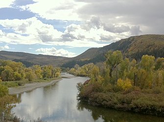
Day 34 (October 2, Craig, CO)
Day 33 (October 1, East of Massadona on Route 40)
Start: Vernal, UT
End: 12 miles west of Elk Springs on BLM land
Today's mileage: 61.6 miles
Total miles so far: 1184 miles
Average speed: 11.6 mph
Max speed: 28.6 mph
Travel time: (09:30 to 17:45) 8.25 hours
Total travel time: 156.5 hours
Weather: sunny, clear, 65-80 F
After a great breakfast cooked up by Pat, and some talk, I headed to the grocery store before hitting the road. The grocery store had small gala apples. I love that size despite it being a rarity in the USA to find apples that small. I bought four. I also bought orange Gatorade mix. First time I have seen any flavor other than lemon-lime in the one pound containers. I think that is a clever ploy by the stores to steer you to the more lucrative premixed drink.
Riding out of Vernal on the eastern end of town are all the oil field services companies. Considering these fields are not huge you can see what big business oil is. There was tons and tons of equipment and supplies. Acres of tanks and pipes and generators and prefab buildings. Pretty impressive.
Just outside of town is the visitor center for Dinosaur national monument. (Combined with the state of Utah welcome center with loads of information on what there is to do in Utah.) The bone viewing center was seven miles up a side road, but it was closed for renovation -- reopening on October 4.
Pat had warned me about the road from the edge of town to Jensen because the shoulder disappears. It did. But shortly after Jensen it went back to a four foot plus shoulder.
Today was the first day I have seen prairie dogs. I am not sure if they were whistling and chirping at me but their noises seemed to increase as I went by. Maybe my relative slow motion made them think I was a threat.
My new front panniers were rattling a bit so I have been looking for the right bungee cord to secure them. Generally there are bungee cords lying on the shoulder at least one mile. Sometimes there is assembly required as hooks are missing but they are there if you are patient. I found two yesterday but one is a bit too long. So I am still on the hunt.
The road to Dinosaur, CO is uphill but the grade is shallow. Unfortunately, the recommended cafe in Dinosaur with the homemade ice cream was closed. So I sat in the little park and ate my food without ice cream. It was good to eat so my bike lost a pound or so. But regained it when I filled my water bottles and then some.
Across the street was the Colorado welcome center. I quickly got on their wifi and grabbed a free Colorado highway map since I only have a map on my iphone. Good to have one that doesn't rely on batteries especially when free.
All the land along Route 40 from Dinosaur to Craig is pretty much BLM land so you can camp anywhere. I was looking to get about to Elk Springs before pulling off to find a site. I gave up a bit before because I felt it is better to find a place before it gets dark. You know better what you are getting.
About nine miles outside Dinosaur I met Allen. He is walking across the country. He started in Seattle in May and hopes to arrived in DC sometime next year after doing a swing through the south. He is walking for a cause to promote gender and sexual equality. He does about 20-30 miles a day. I sometimes feel that I wish I could go faster or cover more miles a day. Biking is much faster than walking. Fifteen minutes after I left him, I had gone four miles. That is a couple hours at least for him. Then I went downhill for almost a mile at 22 mph. He was pushing a cart, and downhill he'd have to run to keep up. Yes, bicycling is much easier.
Shortly after Allen, I had a Mitt Romney sighting. It was an unmarked car which i thought a little odd since he is running for president. What gave him away was the station wagon with the dog in the pet carrier strapped to the roof.
At Massadona there is a restaurant. Its sign says "Steak and Seafood". Hmmm...considering it is not bustling -- Route 40 seems like America's new loneliest road -- and it is about 1000 miles from the coast, seafood would be the last thing on my mind even if it was frozen.
I pulled off the road about half a mile down a BLM road and am sleeping out under the stars. The moon gives some light but the sky is dark and the stars plentiful.
My goal for tomorrow is Craig 67 miles away. That will leave an easy day Monday of about forty miles into Steamboat.
Utah Desert -- Jensen, UT
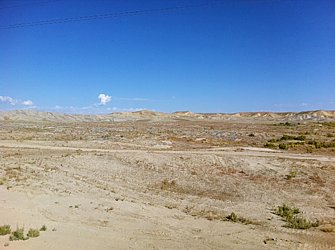


Day 32 (September 30, Vernal, UT)
Start: Camper World four miles west of Duchesne, UT
End: Vernal, UT
Today's mileage: 66.6 miles
Total miles so far: 1123 miles
Average speed: 11.8 mph
Max speed: 31.4 mph
Travel time: (09:30 to 17:30) 8 hours
Total travel time: 148.25 hours
Weather: sunny, clear, 45-80 F
Despite eating a huge dinner, I woke up hungry. It was somewhat windy too but from the west so that was ok. But it made me feel like staying in my sleeping bag until the sun came up. It seemed the new sleeping pad worked. I felt I slept most of the night. That is a welcome change.
I ended up heading out at 09:30. Nobody else in the RV park was moving. I wore my arms and legs plus a wind breaker. About half an hour in I had to pull over to take them all off. Shortly after that I saw another cyclist.
It was Eric from Beijing. He had started in New Jersey and was going to Seattle. What prompted him? The adventure and challenge. I asked him about the route ahead for me in Colorado. He said there are stretches with nothing but only about 50 miles at a time. He got stuck in a blizzard on Berthoud Pass at 11,000+ feet and had to be driven off. I hope my crossing goes better. (The weather from Vernal to Steamboat Springs now looks good.) I also wanted to ask him about his aerobars and Brooks leather saddle.
My butt started hurting around mile forty five again. I think it definitely slows me down for the last few hours of the day. I checked out the saddles at REI and they seemed to be either racing or squishy gel ones. Lots of people recommend the Brooks saddle as the leather breaks in to conform to your butt. I'll think about it.
I am surprised at the amount of traffic on Route 40 besides just the trucks. I guess I thought it would be like Nevada. All the towns here seem much more prosperous than anywhere in Nevada. It might be there is more water here. Not sure. Vernal has a population of about 13,000 and loads of stores. That surprised me too. Again, not like Nevada.
After lunch in Roosevelt at Kody's cafe (short stack of pancakes) I got about five miles and had to stop. I don't know if it was the afternoon heating up or digesting lunch, but I had to stop. I pulled off under a tree and if it weren't for the constant traffic, I would have fallen right asleep. I think I did sleep some. It was very restful and hard to get up after 45 minutes.
From Warm Showers, Pat in Vernal said I could stay at his place. I had texted him the night before after all my attempts to call failed. (I have found that if my phone says "roaming" the call won't go through no matter how many bars I have.) I had told Pat that I would get there about 4:00 but I sent a revised estimate of 5:30.
I got to his house and had a little rest before a shower and a great dinner. Unfortunately, the Yankee-Tigers game was rained out. More unfortunate was that the Red Sox had been eliminated.
Pat also gave some good info about what lies ahead between here and Denver. But now time to brush my teeth, read and sleep so I can do it again tomorrow.
Day 31 (September 29, Camper World four miles west of Duchesne, UT)
Start: Salt Lake City, UT
End: Camper World four miles west of Duchesne, UT
Today's mileage: 56.4 miles
Total miles so far: 1056 miles
Average speed: 11.8 mph
Max speed: 28.6 mph
Travel time: (11:00 to 17:00) 6 hours
Total travel time: 140.25 hours
Weather: sunny, clear, 60-80 F
After a good couple days of rest, being with friends, and taking care of things I left Salt Lake today with a ride out to Heber, UT that saved me a day or more considering the passes involved. Since I am a bit behind schedule that is good.
Despite my elevation profile for the ride from Heber to Vernal looking like it was mostly downhill after Daniel's Pass, it didn't really feel that way. Overall it might have been but there were some definite hills today. On the plus side, I seemed to be able to go up them without stopping and in a gear or two above the granny gear.
The scenery started out being almost alpine but changed to scrub brush and short juniper pines along the way. The aspens around Heber and Daniel's Pass had all turned. Aspens with green leaves are magical in the sun, but the orange and reds with the sun going through them was even more so. I wish they had been close enough to the road for me to go among them.
Route 40 is not a bad road. The shoulder is quite wide and where it is not wide there are two lanes so cars and trucks have lots of room to pass me.
One of the most common vehicles are double trailer oil tankers. They head east empty and west full. There is an oil field near Vernal keeping them busy. Watching the westbound ones go up some of tad hills, I thought, "I could pass that..." Probably not, but they were slow. From the RV park I can hear them going by.
When I got to Starvation Reservoir four miles west of Duchesne, I saw Camper World. I figured in Duchesne there might be a motel but for camping probably nothing much better so I stopped there. Plus it was 5:00 so I'd have two hours before sunset to set up camp and have dinner. Plus, it had a shower.
After my shower, a guy from one of the four RV in the park asked me if I wanted to come by for a beer. I went over, but declined the beer as recently alcohol seems to disrupt my sleep somehow.
I talked with Jim and Ed both from Heber. They were staying at the park for some fishing. The day before had caught a number of rainbow trout so I started off with some great smoked trout Ed made the day before. Jim had been the first vet in Heber and had some good stories from that. He and Ed had a lot of questions about my trip.
Then came BLTs with tomatoes from Jim's garden as well as corn. They insisted I eat up since I had to bike a lot. I had three ears of corn, and left stuffed. It was much better than the boil stuff I had planned. I left very full and happy.
Overall, a good day. Jim said the ride to Vernal should be pretty flat. I like that.
Starvation Reservoir near Duchesne, UT
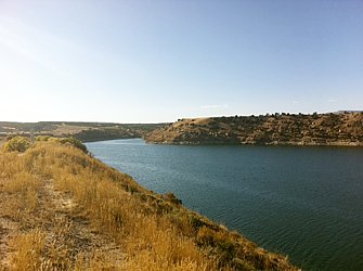

Day 27 (September 25, Salt Lake City, UT)
Start: Eureka, UT
End: Salt Lake City, UT
Today's mileage: 79.5 miles
Total miles so far: 1005 miles
Average speed: 11.9 mph
Max speed: 40 mph
Travel time: (09:00 to 17:30) 8.5 hours
Total travel time: 134.25 hours
Weather: sunny, clear, 55-85 F
I originally thought I'd start out at the crack of dawn. That idea was tossed aside when I got up at 05:00 and really wanted to sleep some more. I just hoped the weather would be more of the same -- temperatures in the 70s.
Waking again at 07:30, and feeling much more rested, I ate breakfast -- raisin bran, s'mores granola bars, triscuits, and yogurt, then started pedaling. There was a short uphill then a 9 mile downhill. Always good to start off with a downhill.
Heading north off route 6 onto Utah highway 68, the sign said 58 miles to Salt Lake City. Riding by cornfields and cow pastures until the road got closer to Lake Utah when the land then was BLM land.
I suppose one could camp on the BLM land as the signs said you could for up to 14 days at a time, but it would not be my first choice due to what everyone was doing.
For about the next ten miles, in the hills to the west of the road, cars and trucks were parked and the reports of gunshots could be heard. The BLM signs said that you had to remove all shell casings and targets. Plus, you were not allowed to use glass bottles or cans as targets.
It was a Sunday so I guess that would explain the couple hundred people out shooting into the hillsides. It took me a while to find a good spot for lunch without anyone doing shooting practice.
When the BLM landed ended, insta-suburb began by the name of Saratoga Springs. The monster houses that had all the architectural styling of the crappy villas popping up in China -- easy to see where the Chinese got the idea for theirs -- were stacked next to each other separated by small patches of green lawn. Each had something to be pulled on a trailer like an RV, ATV, jet ski, or motor boat.
After a few miles, I hit the older suburbs of Salt Lake with modest ranch homes and sometimes even horse farms or cows. With about twenty miles to go I tried the Jordan River Trail. It is a bike path that follows the Jordan River into Salt Lake.
I had read about it online on the Utah Department of Transportation website. The website said there were some gaps and the signage was not consistent. At first I did not mind as it was welcome change from riding on city roads.
The trail wound along side the Jordan River which was pretty high and actually flooded the trail at one point. My first dead end was pretty minor only having to double back about 100 yards. Then a second about the same due to no signage. Then I rode through the standing water about a foot deep where the river had overflowed the banks. But then the trail came to a dead end in South Jordan. There was no way around it surrounded by chain link fence. This time I had to go back almost two miles. I got back onto normal roads. I am sure the trail will be nice once it is all connected and they add signage but for me it was too frustrating.
I was also starting to be a bit tired having gone 70 miles. I just wanted to be at my friends' house.
For some reason my perception of Salt Lake City was that it was all flat except for the sides. That was not the way it seemed while riding a bike. I guess hills are remembered better on a bike. The last five miles was all uphill. I had to push the bike for a bit up one hill. That was more just to keep moving.
It was good to arrive, shower, and head off to a birthday party with a good dinner. Then come back and fall asleep in a comfy bed with nowhere to go the next day. My first day off in a week.
/B>
Day 26 (September 24, Eureka, UT)
Start: Delta, UT
End: Eureka, UT
Today's mileage: 53.9 miles
Total miles so far: 925 miles
Average speed: 9 mph
Max speed: 24.5 mph
Travel time: (09:00 to 17:45) 8.75 hours
Total travel time: 125.75 hours
Weather: sunny, clear, 55-85 F
I did not want to get out of bed this morning and maybe it would have been better to sleep in. Today was the worst time to distance and difficulty.
The route from Delta was almost all flat with some mild hills for the last 15 miles but nothing hard. On the flat I struggled to even do 10 mph and there was no wind. My legs did not have anything in them.
After I got to Lynndyl, only 16 miles, I sat outside a gas station and took a nap for forty minutes.
Even after the nap I couldn't move. It was 36 miles to Eureka. They went by pretty slowly. As it seems with all mining towns, Eureka was up on the top of a mountain. So that was a painfully slow way to end the day.
Eureka has an old Union Pacific caboose in the middle if town next to the fire station. If I couldn't find a place to stay I was considering sleeping in it. But the only motel in town had one room left. Then I went up to the top of the mountain to the Summit Drive In for a burger. The motel and attached grocery store plus the burger place and gas station Next to it seemed about the only thing going. All the 19th century main street store fronts were vacant. The old post office was chained shut.
I had a shower and went to sleep early because there was still 80 miles to go the next day to Salt Lake.
/B>
Day 25 (September 23, Delta, UT)
Start: East end of King's Canyon, Route 50
End: Delta, UT
Today's mileage: 62.3 miles
Total miles so far: 871 miles
Average speed: 11.8 mph
Max speed: 31.7 mph
Travel time: (07:30 to 13:45) 6.25 hours
Total travel time: 117 hours
Weather: sunny, clear, 45-75 F
Gatorade...that sweet taste.
After a night under the stars, I woke to the sun rising over the mountains. Because I didn't have much water left -- only about two liters of water and half a liter of Gatorade -- I had a small breakfast. I decided I'd eat and drink at the same time while riding. Food was not an issue but water was.
My ride started with a mile or two short downhill followed by eleven miles of uphill against a headwind. I knew from looking at an elevation profile there was an uphill and afterwards it would be mostly flat to Delta. It was not fun doing the uphill and not drinking especially as the sun got higher.
As soon as I got over the uphill and started down into the basin, I felt better about my water situation. However the shimmering salt flats, desiccated animal carcasses, and circling vultures suggested otherwise. I figured worst case I'd try to stop a car to see if they had water. This section of Route 50 was more lonely than the potion in Nevada. I'd only see a few cars an hour.
During my ten mile breaks I'd sip the Gatorade. I really wanted to chug it but wanted to make sure my drinks would last. With ten miles to Hinckley I decided to chug it, and it tasted good.
This was the first day that I could not use my GoPro because all the batteries were dead. Unfortunate. The scenery was similar to the scenery in Nevada but different. The mountains of Utah look different. More rock with cliffs. There was also the salt flats that filled most of the basin.
The road was straight for miles on end. The miles ticked off slowly until I neared Hinkley. Then farms started. The addition of farms and side roads as scale was welcome. They made things seem to go by faster.
The green if the corn fields was another welcome change. The farming towns of Hinckley and Delta seemed better off than the mining towns of Nevada.
I checked into a motel for the comfort of a bed, and found a pizza place to avoid another burger.
Dawn at King's Canyon, Rt 50
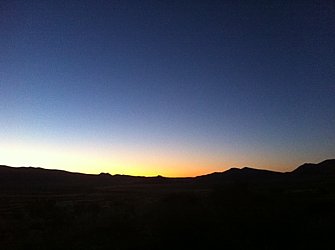
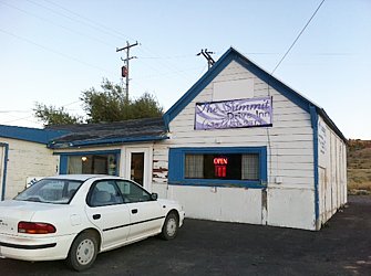
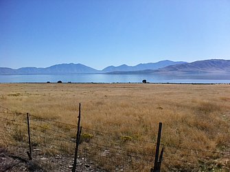
Day 24 (September 22, Highway 50 in Utah near mile marker 30)
Start: Lower Lehman Creek Campground, Great Basin NP
End: East end of King's Canyon, Route 50
Today's mileage: 48.2 miles
Total miles so far: 809 miles
Average speed: 11.7 mph
Max speed: 37.1 mph
Travel time: (10:30 to 18:15) 7.75 hours
Total travel time: 110.75 hours
Weather: sunny, clear, 55-80 F
I am lying looking up at a dark clear sky where the milky way stretches from one side to the other.
A slow start to the day...I had eaten almost all my food requiring a trip to the Baker grocery store. I hoped they'd have something left after the last time I went there. They do not open until 10:00 and it was seven miles of down hill to get there.
After getting some groceries, the plan was to head over eight miles to the Border Inn/Cafe/Slots/Gas station to get some lunch and a motel room. I have not slept well since Ely due to mattress woes.
But all the rooms were booked for the long weekend. Still don't know what the holiday is and when I left at 15:00 only about three of twenty rooms had cars outside. Seemed fishy. Plus, who'd want to stay there?
With my plans for a comfortable bed dashed I had lunch. I am starting to wonder about American cuisine...is there food besides burgers available outside major metropolitan areas? I suppose I could have gotten a steak. But I had yet another burger. It was not bad.
With the burger in my belly and no room to sleep and the noonday sun overhead I headed for a bench in the shade for a nap. The temperature in the shade was a quite comfortable 70. In the sun, over 80. At three I headed east figuring I could get in 25 or 30 miles to make the next day easy especially since all the elevation gains were at the beginning. The sign outside the Border Inn said "No services 83 miles."
The new version of the Pony Express follows Route 50 -- AT&T has a fiber optic trunk line buried next to the highway. Just as with the original Pony Express it has stations every 60 miles or so. They are non-descript little, windowless buildings surrounded by barbed wire and have a backup generator.
Traveling Route 50 by bicycle makes me think of the early pioneers because they followed a similar route. Today I rode ove a couple of little passes that had been blasted out. I wonder if before they were blasted were there wagon ruts over them.
My mom took us to see wagon ruts about 25 years ago. I don't think I fully appreciated them then. I would see them differently now. I was lamenting to a friend about my slow pace over the mountains. She said, "Mountains are tough. If they were easy the settlers wouldn't have as much trouble as they did." Makes sense.
At mile marker 30, the sun had set and
I found a good site off the road where I can't be seen. I decided to call it a day. Tomorrow I have 53 miles to Delta where hopefully I can get a room to sleep. If I leave early I can have the room all day and nap. Trip advisor says there are two restaurants -- at least one servers burgers.
/B>
Day 23 (September 21, Great Basin National Park, Lower Lehman Creek Campground)
Today was a 'rest day' in the park. It was not much of a rest. I wanted to take the Wheeler scenic drive up to the top. That is 10 miles and 3000 vertical feet one way. I did not count the trip back as it was all downhill. the campsite is at about 7300'.
I got going at about 09:15 and was up to the Maher viewpoint by 11:30. It is about 5.5 miles from the camp and is at 9000' plus feet. I ate my lunch -- always good because it makes the bike lighter. Then took a little nap since the noontime sun was beating down.
A couple came out to the viewpoint and we chatted briefly. While leaving the husband asked, "Are you going up to the top? If you want you can get in the back of our pickup and we'll give you a ride. Sounded good to me so I hopped on.
The last four miles and 1000' vertical feet went by really fast. Much easier than pedaling. I felt a touch of guilt or remorse for not having done it myself but he probably saved me about an hour and a half at least. Not to mention my legs for the next day.
My biggest regret was not bringing my lock so I could lock up my bike and go on the hike to the lakes. I looked for a good place to hide it but didn't find one. When I come back I'll do those hikes.
So then was the 10 mile downhill to camp. I got up to 40 mph but the road is windy so I had to brake. My hands were a bit cramped by the end. Still some good fun.
Day 22 (September 20, Great Basin National Park, Lower Lehman Creek Campground)
Start: Sacramento Pass Recreation Area
End: Lower Lehman Creek Campground, Great Basin NP
Today's mileage: 22.6 miles
Total miles so far: 744 miles
Average speed: 9.4 mph
Max speed: 35.5 mph
Travel time: (09:10 to 12:55) 3.75 hours
Total travel time: 103.0 hours
Weather: sunny, clear, 65-80 F
Another late start after a terrible night's sleep. Felt like I was up all night tossing and turning. After a quick breakfast I headed down to Baker to get some groceries for the two nights I planned on spending in Great Basin National Park.
The thirteen miles of downhill were a good way to start the day. After a quick stop at the Great Basin NP visitor center to get some park info, I headed into Baker.
Baker is a three shop town or maybe a few more but only about three interested me -- grocery store and cafes. Unfortunately one of the cafes was closed until next week and the other did not open until lunch time. So I went to the grocery store and felt like I was clearing them out. I bought the last chicken flavored ramen, pretzels, Doritos, cheesy rice & broccoli boil dinners, and single serve shredded wheat and raisin bran.
The road into Great Basin NP is all uphill and with the bright, noontime sun and no wind it got hot. Sweating bullets and inching my way up the constant grade, I realized I might just have enough time to make the 13:00 tour of Lehman Caves -- the longer 90 minute Grand Tour.
I pushed my pace for the last five miles and 1500 vertical feet- up to a blazing 5.8 mph from 5.2 mph - ignored to sweat, tears, and pain to make it in to the visitor center with a whole five minutes to spare. Luckily there was one empty slot just for me. I threw on the arms and legs plus my rain gear and ventured into the cave.
Besides the damp chill of my sopping wet shirt, the tour was good. Lehman was a rancher who found the cave, and then started charging admission. Back in the 1890's it cost $1 to get in. That one dollar got you: a candle and the assurance if you didn't come out within 24 hours they'd send a search party.
Being a limestone cave there are amazing stalagmites and tites as thin and thick columns and wavy curtains of rock. Lehman also had a policy that you could take out what you could break out so there was lots that was damaged. But what remains is pretty spectacular and at $10 probably a much better bargain than $1 was back in 1890.
After the tour I inched my way up to Lower Lehman Campground. Only three miles but took forever. It is an 8% grade all the way up the scenic drive.
I am currently watching Neanderthal TV. What's on? Fire. It is a good episode filled with mystery (will it stay lit???), unpredictable action, and warmth. Soon it will be over and time for bed.
Day 21 (September 19, Baker, NV)
Start: Ely, NV
End: Sacramento Pass Recreation Area
Today's mileage: 52 miles
Total miles so far: 722 miles
Average speed: 10.8 mph
Max speed: 36.3 mph
Travel time: (09:00 to 16:45) 7.75 hours
Total travel time: 99.25 hours
Weather: sunny, 45-90 F, mostly clear, light winds
Getting a very late start (09:00) from Ely the road was all uphill to Connor's Pass. It was not steep but just constant. I thought it was just my usual morning slowness but after an hour and a half of not getting into a speedier groove I realized it was because it was all uphill.
The scenery was more of the same basin-range with sage brush. It was still dramatic and beautiful.
After Connors Pass, I went to Major's Place in Major's Junction for lunch. It serves a small amount of food -- probably all frozen-prepared but I enjoyed the chicken tenders and my Dr. Pepper. It was starting to heat up and I decided to camp out at Sacramento Pass, I took a long hour and a half lunch. Being a bar in the middle of nowhere, it seems to have a bit of a mystique. A biker rode up on his Harley. He was from North Carolina and said the last time he'd been there was 1976 but was taking a long trip around the USA and decided to stop by again. Another biker couple rode in. They'd last been a few years earlier and several times before that.
The ride down into Spring Valley from Majors Junction was one of those long straight runs that you wonder when you'll get to the other side. It always seems about the same distance until you are there.
The slow but steady grade up to Sacramento Pass started to wear me down. It was getting hotter as the day went not cooler. I checked my little key chain thermometer; it said over 90 F. The heat was sapping my energy. I pulled off the road, under a tree and took a forty minute nap before continuing up and over.
I pulled into the Sacramento Pass Recreation Area rest stop (camp ground) for the night.
Day 20 (September 18, Ely, NV)
Today was a rest day even though didn't really need one. I wanted to ride the Ghost Train.
I started the day with pancakes from the Silver State Restaurant. Seems like a pretty local place. Well, besides the guys driving the two Vipers and the Corvette parked outside, everyone else seemed to be local.
After breakfast, I walked over to the Nevada Northern Railway Museum at the old Ely passenger depot. It used to be an important part of town with the old, turn of the century storefronts. But now the storefronts are mostly boarded up, vacant, or falling down. Now the town is sort of a series of motels along Rt 50 most of which my father would have proclaimed, "What a DUMP!" and those are the open ones. There seem to be an almost equal number of ones that are closed down with peeling paint and weeds taking over the parking lots. Interspersed among the motels in various stages of doing business are other stores most of which are vacant and for sale.
The train I was going to ride is a steam engine. I was not surprised to see that a number of people were already on the platform taking pictures as the locomotive slowly backed into the passenger cars to hookup. Trains in general bring enthusiasts but steam locomotives are probably even more so. As they were watching it back up and take pictures they compared notes with other steam locomotives they'd seen.
There were about 30 people there for the two hour ride. Plus two guys who paid extra to ride in the locomotive. Knowing there were two tunnels right outside Ely and it was uphill to go through them, I initially chose to sit inside. Good idea since the engine was working harder and belching out more smoke and cinders that completely filled the tunnels. The rest of the ride I sat on the open car.
The railway is now almost all volunteer (they are fixing up a building into a dormitory for volunteers who come from all over the world to work on the trains), and seems to make most of its money from photo shoots. People pay big money to take pictures of the steam engines. The other big draw is getting a chance to ride in the cab or even drive. After our ride ended, someone had rented the train for several hours to drive it around.
We got off and got a tour of the workshops. It was interesting seeing the massive lathes, pressed, and mills that they use to keep the trains going and to work on the trains they want to restore. In the shop was their other working steam locomotive. Then we got a tour of the engine house where working and nonworking locomotives were stored.
I like the train ride. There was some interesting history and sites on the hour out and hour back ride. I thought it would be through more ghost towns from the description, but still OK.
On the way home from the train ride I stopped at the White Pine Public Museum. It had collected memorabilia from Ely. It would have been nice if it told more of a story, but it was an interesting stop.
I finished up the day with a cheese burger and chocolate milkshake from the Silver State Restaurant.
Day 19 (September 17, Ely, NV)
Day 18 (September 16, Illipah Reservoir Campground)
Start: Eureka, NV
End: Illipah Reservoir Campground
Today's mileage: 44.6 miles
Total miles so far: 630 miles
Average speed: 10.4 mph
Max speed: 31.7 mph
Travel time: (10:30 to 15:30) 5 hours
Total travel time: 87.75 hours
Weather: cloudy, 50-60 F, strong winds, thundershowers, hail, rain
I just spent the last 15 minutes holding my tent in place. A front was moving through and ultralight tents are not designed for winds gusting to 50 mph. So with one hand trying to keep the fly near the ground to reduce the rain blowing under it, I held the poles in place with the other. The tent was still whipping around in every direction. I was glad I went a bit overboard and had put fifteen pounds of rocks on every corner.
It is still raining out and a bit of wind. But getting less and I can see the sun to the south where the wind is coming from. I stuffed my gore-Tex jacket and dry bag against the south end of the tent to try to keep out the rain. I seem to remember my brother saying, "If it rains, you'll get soaked." Well, not quite but somewhat.
I checked the weather report and it said today had a 70% chance of thunder showers but tomorrow should be nice. On the radar image there was a big green blob of rain going right in between Eureka and Ely. Hopefully the sun I see is the bottom edge of it.
I biked the last hour or so in the rain...until it turned into hail. Little pea sized balls of ice. It stopped as I was pulling into camp, and I was able to change into dry clothes, eat some hot noodles, then set up my tent.
While riding in the rain, I was thinking that a really lightweight bivy like the one Jian had would be nice to go inside my tent. I have a down bag that can't get wet. His is only 7 oz which is less than then inner tent. It will also be nice when it starts to get colder.
I also might get a nicer sleeping pad. A full length pad that is twice as thick can actually weigh less than the 1.5" 3/4 length one I have from REI. In Ely I look into order the bivy and sleeping to pick them up in Salt Lake.
Oh, here comes the rain again. I set up my tent underneath a rain/sun shelter for a picnic table. Right now the rain just seems to be hitting the shelter. It is a metal roof so the rain is probably only half as bad as it sounds.
I was hoping to crawl into my sleeping bag, but will wait on that. I am going to use my space blanket as sort of an inner ground sheet to help keep my sleeping bag dry.
I woke up at 06:00 today, and it was raining so I went back to sleep after checking the forecast which was for improving over the day. At 09:00, it was drying up, and after letting my breakfast digest, I started riding at 10:30. I seemed to be running into thunderstorms most of the way. At Pancake Summit, I stopped and got into my rain jacket. After Antelope Summit (7500'), even though the camp ground was only three miles away, I stopped to put on my rain pants. That was mostly due to the temperature drop associated with the hail. Today was the first day I was happy to have fenders.
Illipah Reservoir is pretty nice. The is a little reservoir and a bunch of tent/RV sites with shelters over the picnic tables. People say there are people who have drunk the reservoir water untreated, but considering I can see cows grazing at it's edge I would say untreated isn't a great idea.
I'll cook up a little dinner and then hit the sack. Another short day tomorrow into Ely. I am behind schedule for crossing the Rockies by October 1. I should be about 200 miles further on. It will all work out in the end so I am not worried.
Hopefully no more storms in the night!
Day 16 (September 14, Eureka, NV)
Start: Austin, NV
End: Eureka, NV
Today's mileage: 72.9 miles
Total miles so far: 583 miles
Average speed: 10.7 mph
Max speed: 40 mph
Travel time: (07:30 to 16:45) 9.25 hours
Total travel time: 82.75 hours
Weather: mostly cloudy, 45-75 F, strong winds, isolated thundershowers
Today was perhaps the hardest day so far. It had all my nemesis: hills, wind, distance, rain, and general soreness.
Right out of the RV park the hill started. It was a little over 1000 feet, a nice two mile descent, followed by another 600 foot climb. Later there was another 600 foot climb and just for good measure there was a 600 foot climb into Eureka.
The long 50 miles in between the descent off the summits out of Austin and climbing into Eureka was long. It was punctuated by headwinds and thunderstorms with driving rain. Luckily the rain only lasted for about an hour.
While doing the third climb of the day, I was thinking, "Some people go out and ride up hills for fun." Considering my focus on moving up hill it took me a few minutes to realize the irony, and think, "Yeah, that would be me. That is what I am doing now. Fun."
Sometimes the scenery can make me remember why I am doing this. The basins and mountains can be beautiful. The scale and desolation is great.
Another exciting thing of the day was going through a repaving group today. It was quite a set-up with multiple semis, asphalt diggers, asphalt chewers, and repavers all hooked together. The train of vehicles was at least a football field long.
After making it finally to Eureka, I met up with Jian at Uncommon Grounds -- a coffee/smoothie cafe. I had a candy cane blizzard. Pretty good. The when it closed we moved next door to La Fiesta. I inhaled three enchiladas. After staying on a bit to recharge batteries, we camped in the public park a few hundred feet from
La Fiesta.
Tired. But glad to have made it.
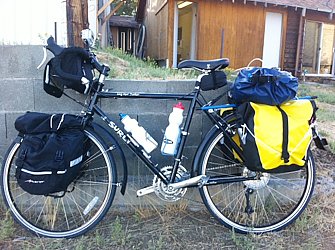
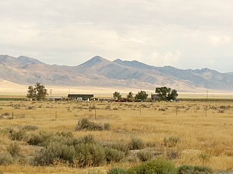
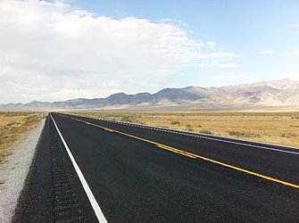
Day 15 (September 13, Austin, NV)
Start: Cold Springs Station, NV
End: Austin, NV
Today's mileage: 53.6 miles
Total miles so far: 510 miles
Average speed: 10.3 mph
Max speed: 28.6 mph
Riding time: (07:45 to 14:15) 6.5 hours
Total riding time: 73.5 hours
Weather: mostly cloudy, 45-75 F, light winds, isolated thundershowers
Leaving Cold Springs this morning it was a bit chilly. I wore both the arm and legs plus my welding cap (cotton helmet liner) and a wind breaker. After an hour I was able to take off the arms because it had warmed up to about 60 from 40 F.
The scenery was more basins and ranges. The smell of the sage grass was quite strong early. The sun mostly hid behind patchy clouds. All day thunderstorms and rain could be seen at different points in the basins.
After a couple of hours and about 20 miles I came to resurfacing road work. I was able to ride through on my own, but all other cars and trucks needed to have a lead car to follow. This turned out to be quite nice for the rest of the day's ride. The one-lane traffic and lead car met that traffic was stopped for about 30-40 minutes before being released. For the rest of the day I'd have no cars for 45 minutes or so and then they'd all come by in a few minutes. Id pull over, waiter for them all to go by then the road would be mine for another 30-40 minutes.
The two summits had very shallow grades up them and I could pretty much just pedal all the way up. After the second pass, there was a 13 mile coast to within three miles of Austin.
I had not been counting on all the rooms in Austin being full. Road work crews. So I had a cheese burger at the International Hotel that is now only a bar and cafe. After a long lunch, I headed up to the local Baptist church that also had a camp ground. It was not scenic or appealing but I didn't have it in me to do another 1500' to the campsite outside of town.
At the campground I met two Swedes. One going east and the other west. I had dinner with them at the other restaurant in town - Toiyabe Cafe. (not as good food or service as the International Hotel) The westbound Swede, Pear, worked as a stagehand for an opera company. He had gone on the Trans Am route two years ago and wanted more. This time he did the Rockies by mountain bike. He was on his way to SF to end his trip that started in May. He said most years he has five months of vacation -- "Usually it's about enough."
The other Swede heading East, Jin, originally from Tianjin decided to see more of the USA before heading back Sweden for business school.
Day 14 (September 12, Cold Springs Station)
Start: Fallon, NV
End: Cold Springs Station, NV
Today's mileage: 65.5 miles
Total miles so far: 456 miles
Average speed: 11.3 mph
Max speed: 29.6 mph
Riding time: (08:45 to 16:00) 7.25 hours
Total riding time: 67 hours
Weather: partly cloudy, 65-80 F, light winds
I decided to have a late start but with a good reason. I wanted to go to the post office to mail off some weight. The post office did not open until 08:30. I was surprised that my box weighed 4.5 lbs. Good to get rid of the excess! Now I can add more water.
I headed out of Fallon at about 08:45. Right outside of Fallon I got to see the F-18's that I wanted. I also got to see what looked like F-106 Delta Darts and another plane that I am sure I have a model of from back when I used to make lots of model airplanes. They were low and loud.
I was able to get into something of a groove today. The first 30 miles were pretty easy.
Maybe Route 50 was the 'loneliest road' at some point a long time ago, it is no longer that way. I was passed by cars, motorcycles, RVs and semis quite a few times an hour.
I met another group from London that was cycling cross country to raise money for a charity. They were doing a relay with about four or five people and RV support. They started in San Francisco yesterday and are on their way to NYC. I accepted they had done in two days what took me two weeks. They don't carry anything, and they are riding light, fast road bikes. I figure they are doing about 300 miles a day.
The scenery is stark and beautiful. There are no trees and nothing but some sage brush and grasses. Dixie Flats where the Navy has it's bombing range is desert. Nothing. Unfortunately no bombing runs when I rode by.
There was another Nevada state historical marker by the bombing range about Fairview. It was a silver mining boom town from 1905-1908. At it's height in addition to banks, hotels, and a newspaper, it had 27 saloons. I always find it amazing how many saloons these towns had. I suppose you need more than one so that people who are kicked out of one have somewhere to go.
The temperatures were in the 70s except for an hour or two where they went up to the 80s. There was a light breeze for the most part. I never really felt it was too hot. That was a huge relief.
I reached Middlegate at 14:00. When I got there I checked my mobile and was surprised to find I had five bars so I called my mom. So much for isolated and lonely.
My friend Marko used to live in Eureka. He thinks that as soon as it was labelled the loneliest road in the US people flocked to see it. If it were compared to lonely roads in Australia it would not even rate in the top ten...well, maybe it would. Does Australia have ten pave major highways? Pretty sure outside of Perth in Western Australia there are only about three for an area about half the size of the USA.
Since it was still early I decided to head on another 14 miles to Cold Springs Station -- a former Pony Express station. I started out fast due to the building thunderheads and drops of rain. But those last three miles seemed to last forever. There is a new restaurant with camping and rooms. I had the dinner special: BBQ chicken. It was good.
Day 13 (September 11, Fallon, NV)
Start: Silver City, NV
End: Fallon, NV
Today's mileage: 34.4 miles
Total miles so far: 391 miles
Average speed: 10.75 mph
Max speed: 20.6 mph
Riding time: (07:30 to 11:00) 3.5 hours
Total riding time: 59.75 hours
Weather: clear, about 75 F
I got up a little before dawn and was rolling by 07:30. I had to stop to get some water and switch out the memory card on my GoPro. I was happy to see it indicates when the card is full. I picked up another few cards in Reno.
I had the unhappy find that Highway 50 switches the layout of the shoulder rumble strip. It is now in the outer 'half' of the shoulder so I pretty much have to ride on the line or in the road. Luckily there are not many cars and almost all drove by half or completely in the other lane.
I only had about 30 miles to go today but it seemed like one of the longest days I have done. Not sure why. I couldn't find a groove. It seemed that no gear was the right gear -- one was too hard but drop to the next lower and it was too easy. I was looking at the cycle computer every few tenths of a mile.
I did like when the Nevada historical markers would appear. They provided a good reason to stop. The are interesting. I liked the one today on Ragtown outside Fallon. When the wagons were coming to California over Carson's Pass, Fallon had the first water for weeks. When the settlers arrived at the river they'd wash clothes that were then hung on all the trees and bushes -- hence Ragtown.
I encountered something new on this trip. The wind started picking up as the day went on. I have heard it normally does that. It was not too bad and was from the side, but still made riding harder.
I got to Fallon at about 11:00. It is a veritable booming metropolis compared with the other cities I went through. It is the home to the US Navy Top Gun fighter pilot school and the Blue Angels. Maybe I'll see them flying around when I drive by. There is also a bombing ranging at Dixie Flats.
I did not sleep well at all last night so I decided on a motel -- America's Best Value Inn. The owner said that a lot of bicyclists stay here and that there are quite a few going solo. Two days ago a group of five people from MA came through. They were going much faster than me -- four or five days from SF to Fallon.
Fallon used to have a main street -- Maine street but has since turned into a sprawl of chains and strip malls. It is sad to see what could be a town center that has charm be run down due to sprawl.
Riding into town I saw that the local Rotary Club met at Jerry's Restaurant. After reviewing the options of chain restaurants, it was an easy choice to check out Jerry's plus it had the Rotary Club going there. I had breakfast for dinner. They also had a meatloaf special that sounded good.
Tomorrow ride on to Middlegate. It will be 50 miles. There is 1500' elevation gain and all at the end. Hopefully get there in about 6-8 hours.
Day 12 (September 10, Lahonta State Recreation Area (south of Silver Springs, NV))
Start: Carson City, NV
End: Lahonta State Recreation Area (near Silver City)
Today's mileage: 42.3 miles
Total miles so far: 357 miles
Average speed: 12.4 mph
Max speed: 32.1 mph
Riding time: (12:00 to 18:00) 6 hours
Total riding time: 56.25 hours
Weather: partly cloud about 80 F
Despite getting a really late start -- noon -- and a two hour lunch I got some miles in. I ended up doing about 42 miles.
I started the day watching hot air balloons flying floating around for Reno's annual hot air balloon festival from another JIRPer's deck in the hills north of Reno. It was a relaxing activity and sad to be leaving after a short time but I had to keep moving.
I dropped of the rental car and started riding at noon. The temperature was only 75 in Carson City. I was barely sweating by the time I got to Dayton ten miles away. After a cheeseburger for lunch it was about 90 F so I took a hour nap until 3 pm. It had dropped back to 80 F and was pretty good for riding.
I considered staying the night at the campground right north of Dayton but all the unoccupied sites backed up onto Route 50 so they would be loud. So I rode on to Silver City. About 14 miles from Silver City I got my first taste of what riding through Nevada will be like.
I crested a hill and the road stretched out straight in front of me to the horizon. I thought, "That will be the next hour or so of work..." it turned out to be ten miles.
I stopped part way along to get something to drink at the liquor store in Stagecoach. The towns are starting to look more run down. There is a lot for sale that looks near abandoned.
The road surface is pretty good and fast here. So far it was about a three foot wide shoulder but half is a rumble strip. So I have an 18" wide smooth should to ride on. And car coming onto the shoulder will hit the rumble strip before getting to my half.
I got a sausage sub at the Pizza Factory in Silver Springs. Besides it, a hardware store, two casinos and a gas station the other businesses seem to have gone out of business.
From there, I rode another five miles down to the lake to camp. I might not have found a set-up camp ground and camped out in a cove on the sand.
The moon is full and later in the night it was bright. A headlamp was not necessary to see everything.
Day 11 (September 9, Truckee/Reno)
Another day off to visit another JIRPer in Reno, Chris, plus do some shopping. I had to return my sleeping pad to REI since it has developed a leak. Hopefully no more nights of rotisserie hips -- turning over every hour once a hip starts hurting.
Day 10 (September 8, Truckee, CA)
Day 9 (September 7, Truckee, CA)
Start: Woods Lake, CA
End: Carson City, NV
Today's mileage: 52.4 miles
Total miles so far: 311 miles
Average speed: 13.95 mph
Max speed: 43.96 mph
Riding time: (07:10 to 14:30) 7.5 hours
Total riding time: 50.25 hours
Weather: clear, about 75 F
I started the morning at Woods Lake. It was below freezing when I woke up in the morning. Preview of things to come...
I was eating breakfast at about 05:30 and packed up ready to go at 07:10. I think the chill slowed me down a bit. I know it made it harder to eat my oatmeal. Cold oatmeal is gag inducing in someone who doesn't like it to begin with. Lucky I had some hot chocolate to wash it down.
The sun was up but the west side of the pass was still in the shadows. It was fairly cool ride up to the top. I wore the arms and legs for the first time in addition to a wind breaker while climbing.
Once at the pass, due to the construction there was a backup of cars waiting to go east. I stopped, put on more clothes for the descent. The flag man let me go through last so I'd know there'd be no cars behind me for my whole descent.
After a five mile downhill at about 35-40 mph, the road flattened out and I could go on at 12-15 mph.
The route goes through horse pastures as it continues on to Carson City. The closer to Carson City there were more and more road cyclists. I stopped for lunch in Genoa at the Genoa General Store. Genoa is the oldest permanent settlement in Nevada and has kept some of the older buildings.
Arriving in Carson City around 2:30, I picked up a rental car to head up to Truckee. I drove up the west side of Lake Tahoe and was very happy I did not try to ride it. Steep inclines with no shoulder, steep fall offs, and heavy traffic. I figure it would have taken two days and not at all been fun.
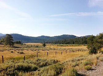 Over Carson's Pass
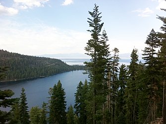 Emerald Bay, Lake Tahoe
Day 8 (September 6, Woods Lake a couple miles from Carson's Pass)
Day 7 (September 5, Silver Lake, CA)
Start: Cook's Station, CA (elevation 5000')
End: Silver Lake, CA (elevation 7300')
Today's mileage: 26.8 miles
Total miles so far: 243 miles
Average speed: 7.7 mph
Max speed: 40.1 mph
Riding time: (05:10 to 12:00) 6.75 hours
Total riding time: 38.25 hours
Weather: clear, about 65 F
Thank Goodness for Granny
I am now taking a break at the Shot Rock Vista. It is about 19 miles from Cooks Station. I left Cook's Station at 05:10 this morning after getting up at 04:00. Again my first hour was tough. I seem to get more into a groove after a couple hours.
I still have to take breaks while going up hill sometimes as often as every tenth of a mile to clear the lactic acid. The title of this post relates to my being thankful for my granny gear. It is my favorite gear for the Last few days since Folsom. Certainly within a couple of gears of my granny gear are where I spend probably 80% of my time. I can go about 5 mph when in the lowest gear.
In a few weeks I hope to be able to go longer without stopping. My legs are still wimpy.
Later...
One good thing about getting higher up is it is not hot. I started the day at about 65 F and a few hours later after the sun came out it was 55 F. When I arrived at Silver Lake around noon it was 70 F. Still quite rideable but I did try to break in the shade.
Hopefully it will be cool tonight and I can get to sleep. At Cook's Station it never dropped below 65 F and that is too hot for my sleeping bag. I kept getting in and out. I have an ultralight sleeping bag so it only has a half zipper -- you are either in the bag or not.
I would also wake up to the 'music festival' that was going on several miles away. The reason for the quotations around 'music festival' is it was several miles away and I could quite clearly hear the lyrics and the bass lines. It might have been better described as a festival to promote premature deafness. Maybe that is unfair as I had lunch with some women from LA who were going to it and said it was great music. The music was still going when I got up at 04:00.
I am probably of one of the last generations not to gave headphones near permanently inhabiting my ears. (Although that might have helped keep out the spider...) I read about people saying it was necessary to have an iPod to have something to listen to especially some sort of power music for the climbs. I prefer not to listen to anything. I like the quiet moments when all I can hear is my chain going around and the tires on the road. Plus I wouldn't be able to hear the cars/trucks coming. Maybe in Kansas I'll change my mind.
To take one from my friend Mr. Anderson, I always have the voices in my head to listen to.
Later still...
I am sitting down by the lake. It is near sunset. It is very quiet. I think this is some of what I miss being in Beijing. I am sure there are parts of China where you can sit by a lake alone and it is quiet and serene, but I am just not sure where they are. Certainly not within 100 miles of Beijing.
At Beal Point I talked to a man who used to go to Malaysia fifteen years ago or so. He said that when he'd come back to the USA he would not complain about his taxes that paid for clean water out of the tap, sewage treatment, trash removal and those sorts of things. I'd have to agree. The first time I was confronted with filling my water bottle in a sink in California, I hesitated then remembered I am no longer in China.
I have been thinking of a post about the difference between riding here in the USA and in China. China does have a few advantages.
Anyways, it is time to concoct something for dinner. I did not realize the restaurant here is closed Monday nights. The people told me I could go up to Kirkwood that is "only five miles up the road" or back three miles to another place. Both of them involve elevation gains of 500+ feet. Not an easy jaunt just for a meal.
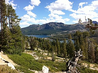 Silver Lake
Day 6 (September 4, Cooks Station)
Day 5 (September 3, Outside Fair Play)
Day 4 (September 2, Placerville)
I could not sleep last night. I was surprised considering I felt exhausted, but could not fall asleep until about 3 AM. There went my plans of waking up at 05:00 and be out by 06:00.
Considering I am tired and there was stuff to think about -- how to get across Nevada and then to Salt Lake -- taking a day to sort things out is ok.
So what's what am I doing on my day off? Mostly sitting in the library waiting for my files to copy off my memory cards for the Go Pro camera. My friend Kendall originally suggested I buy one to record my ride. I was unsure, but my brother was really excited by the idea and convinced me the extra weigh would be worth it.
My brother calculated that at taking a picture at 10 second intervals would allow enough footage for an hour plus long video. I looked at the images from every 10 seconds and decided that every 5 seconds will create a more fluid video.
I mounted the camera to my front rack which I almost bought just to mount the camera on. I figured it is better to have it securely mounted in one place than to have a more jerky Video created if the camera were mounted to my helmet. The one downside of the front rack mounting is it is low to the ground.
The other issue is the vast quantity of data. I make about 12 GB worth of pictures every day. I bought out a Staples store of all their 16 GB SD cards plus bought a 1 TB USB drive to copy everything onto. I have to transfer to the drive once a week. I think I might have to buy some more cards for crossing Nevada.
The next problem is the batteries. It goes through three batteries per day and I only have four. I will probably have to buy a solar charger.
The other thing the camera does means is that I don't feel compelled to stop and take pictures. I am relatively confident that the Go Pro will take a picture for me. Maybe not the perfect picture but something. If weight, batteries and memory were not an issue I'd get the Go Pro 3D and shoot the trip in 3D.
I mailed home two pounds of stuff today so maybe adding a one pound solar battery charger will be ok. Not really, but if I want the video...luckily the memory cards weight nothing.
After two an a half hours at the library I was hungry so ate at Tom's Burgers & Frosty. It got fries, deluxe burger, and a chocolate milkshake. It looked like an All-American burger joint, and it was good. The shake was chocolaty and not too sweet. The burger and fries were pretty classic.
Day 3 (September 1, Placerville)
Day 2 (August 31, Beal Point Campground)
Start point: Winters,CA
End point: Beal Point Campground, Folsom, CA
Today's mileage: 70.2 miles
Total miles so far: 130 miles
Average speed: 11.68 mph
Max speed: 26.38 mph
Riding time: (08:45 to 17:00) 7.25 hours
Total riding time: 15 hours
Weather: clear, about 75 F
For someone who was in charge of organizing large scale camping expeditions, I am failing at this one person camping. What do I mean? Basically, not eating.
Yesterday I was going to head to the county camp ground at $8 a night instead of the expensive B&B, but then I realized I had no butane for my stove. Oh, and no food besides some goo energy packets and a couple clif bars. I figured I would need more. So I went for the B&B and steakhouse dinner.
But today, I went grocery shopping and even bought butane. However I forgot to buy fat for cooking. I have no butter or oil. Whatever, I was going to try quesadilla anyways. So I had it all set up when I realized I had no way to light the stove.
Oh, and I will be 'treating' myself to breakfast at a restaurant. Yeah, not enough food for breakfast. I'll have to do a bit better than this shortly when there are no restaurants.
Right now I am sitting waiting for my time lapse camera batteries to charge. The campground host let me plug into his RV hookup. I wonder what I will do a bit later because the camera goes through three batteries a day. I have four. I guess just ask random stores to plug in for a bit when I go through. And not film some days. Maybe I can get a solar charger or a generator. But probably not until Reno, Salt Lake City, or Denver. Too bad because there is some stunning scenery coming up.
Deep thought of the day: I can't sleep in. While this is a vacation and I can really do what I want, to accomplish the goal of going cross country I'll have to get up early almost every day and ride all day. No lazy days. Well, maybe a few lazy days...
I liked the sacramento river trail. It could use some better signage, but pretty nice. There were three or four cyclists who rode along with me to talk about what I am doing. All gave some useful advice.
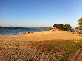 Beal Point
 Downtown Sacramento
Day 1 (August 30, Vallejo ferry)
Today's mileage: 60.6 miles
Total miles so far: 61 miles
Average speed: 11.45 mph
Max speed: 35.87 mph
Riding time: (08:45 to 16:30) 7.75 hours
Total riding time: 7.75 hours
Weather: clear, about 75 F
I left the dog patch at a little after 06:45 in the morning to catch the 07:35 ferry to Vallejo. It was foggy and cool but the people getting off the ferry said it is warm and sunny over on the other side of the bay.
Only four people got on the ferry. Each of us had a bike. The other three were going on an "off-site" which they said is the new corporate word for a retreat. Two of them had serious bikes and laughed that it was for only a 15 mile ride up to Napa.
Last night I did not sleep well. I woke up at about 4 AM and did not really fall back asleep. I think it was mostly due to starting my trip. The nervousness of the unknown.
While I have driven from SF to Tahoe, going on a bike is entirely different. I was looking over my maps with my friends last night and they thought the elevation profiles looked rather imposing.
The first mountains I meet is a 9000' elevation gain relatively fast. How will I do on the hills? Especially now that I have an extra 30+ lbs. (I weighed my gear and it came in at 31 lbs. Right where I wanted it.)
It is the unanswered questions...and there are loads of them. My friend Poorab, from whose house in the Dog Patch I sort of officially started to ride cross country, he said if he were doing it the biggest question would be if he could do it mentally.
Almost everyone I have talked to who did it said there were days they were in tears. But I guess if you keep your feet moving in circles you keep going forward and it will get better.
When I got off the ferry I met a guy who had just finished riding from Yorktown, VA across the USA. His reason for doing it was he retired on June 21st and started riding on June 23rd.
He rode his ten year old bike that he added a new seat from Walmart. (He said the first ten days on it was a nightmare.) It did not have granny gears - a double chain ring in the front and no large cogs in the back. He towed a trailer which he said he'd never do again.
His highlight that he talked about several times was riding at night through Capital Reef in Utah at night under a full moon. My experience is that capital reef is pretty stunning during the day so under a full moon I could imagine it being magical.
He did a lot of riding at night. He said it was too hot to ride in Kansas, Colorado, Utah, and Nevada during the day.
He also recounted some of his lower moments. Outside Cedar City, UT his tire blew apart at 2 AM. He thought it was the end of his travel for the night since he did not have a spare. But a pickup truck pulled up next to him. It was a guy he had talked to the day before at a diner who happened to be driving to the next town in the middle of the night. He threw his bicycle in the back and got a ride.
He said there were a number of times he was brought to tears going over some mountains, but that overall it was a great experience. He was thinking of doing the northern route or the southern tier.
My ride was not too eventful...which is good, I guess. There were some steep hills in Vallejo that I was not really ready for first thing in the morning. The first break I took, I went off the road, and when I went back on, I noticed my wheels were full of thorns. Luckily none of them seemed to have made it to the inner tube. I did get a flat later on a piece of glass. It shredded my inner tube with about ten slices 1/16th of an inch so instead of patching I had to replace. Then cyclists rode by and offered to help if I needed it. I was back up and pedaling in about eight minutes.
The route went through rolling hills covered with parched yellow grass and dotted with dark green trees. There were lots of horse farms and as I approached Winters there were many orchards. Sometimes the orchards provided shade over the road but generally the sun beat down.
It only felt hot on the hills when my speed slowed so I was not creating enough breeze as well as exerting more. I felt like I got stronger over the day until the last hour. My butt started to hurt and my feet hurt or would tingle like they were going numb. Both of those should go away as I ride more.
I had no profound thoughts as my thoughts would be interrupted by hills or trying to remember to look out for signs.
I had a steak dinner at the Buckhorn in Winters. For being ranked the best steak house in Yolo County for five years or so, I was expecting more flavor.
I stayed at the Abbey House which is nice but I was hoping for something cheaper. I called the camp ground, but then realized I had no food nor did I have butane for my stove. The shower and soak in the tub were nice plus I washed some clothes in the sink.
Now it is time for bed so I can do it all over again tomorrow.
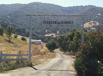 Near Winters
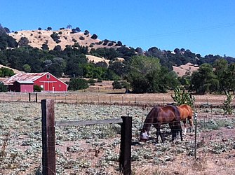 Near Winters
Return to Ben's main page.
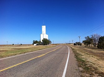

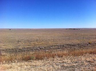
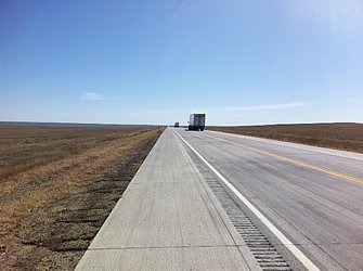
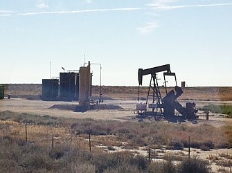
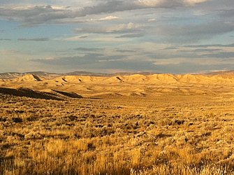

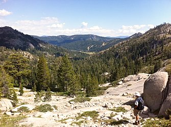 Squaw valley near Shirley Lake
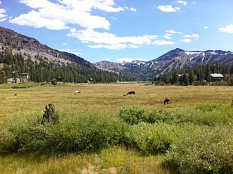 Kirkwoods ski area 5 miles before Carson's Pass
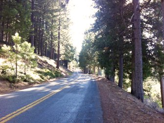 El Dorado National Forest
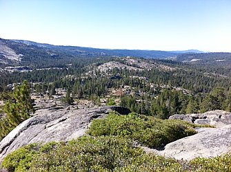 Shot Rock Vista
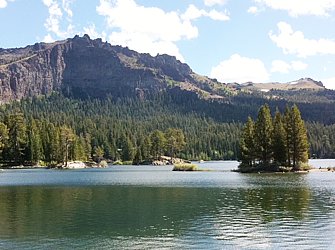 Near Silver Lake
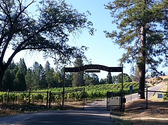 There are lots of vineyards nearby (no time to sample).
 My spider
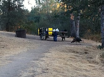 Turkeys in the campground